
Founded 1827 Area 1,308 km² Named for David Meriwether | Website meriwethercountyga.us Population 21,232 (2013) | |
 | ||
Rivers Flint River, East Trammel Branch, Sulphur Creek | ||
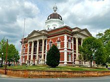
Meriwether County is a county located in the west central portion of the U.S. state of Georgia. As of the 2010 census, the population was 21,992. The county seat is Greenville, home of the Meriwether County Courthouse. The county was formed on December 14, 1827 as the 73rd county in Georgia. It was named for David Meriwether, a general in the American Revolutionary War and member of Congress from Georgia.
Contents
- Map of Meriwether County GA USA
- Geography
- Adjacent counties
- 2000 census
- 2010 census
- Media
- Communities
- References
Map of Meriwether County, GA, USA
Meriwether County is part of the Atlanta-Sandy Springs-Roswell, GA Metropolitan Statistical Area.
Geography
According to the U.S. Census Bureau, the county has a total area of 505 square miles (1,310 km2), of which 501 square miles (1,300 km2) is land and 4.2 square miles (11 km2) (0.8%) is water.
The eastern two-thirds of Meriwether County, going east from just west of U.S. Route 27 Alternate, is located in the Upper Flint River sub-basin of the ACF River Basin (Apalachicola-Chattahoochee-Flint River Basin). The western third of the county is located in the Middle Chattahoochee River-Lake Harding sub-basin of the same ACF River Basin.
Adjacent counties
2000 census
As of the census of 2000, there were 22,534 people, 8,248 households, and 6,012 families residing in the county. The population density was 45 people per square mile (17/km²). There were 9,211 housing units at an average density of 18 per square mile (7/km²). The racial makeup of the county was 58.9% White, 40.4% Black or African American, 0.6% Native American, 0.1% Asian, 0.07% Pacific Islander, 0.34% from other races, and 0.71% from two or more races. Of the population 0.85% were Hispanic or Latino of any race.
There were 8,248 households out of which 31.50% had children under the age of 18 living with them, 49.00% were married couples living together, 18.40% had a female householder with no husband present, and 27.10% were non-families. 23.80% of all households were made up of individuals and 10.60% had someone living alone who was 65 years of age or older. The average household size was 2.68 and the average family size was 3.18.
In the county, the population was spread out with 26.60% under the age of 18, 9.00% from 18 to 24, 27.20% from 25 to 44, 23.60% from 45 to 64, and 13.60% who were 65 years of age or older. The median age was 36 years. For every 100 females there were 91.40 males. For every 100 females age 18 and over, there were 86.50 males.
The median income for a household in the county was $31,870, and the median income for a family was $37,931. Males had a median income of $29,766 versus $21,444 for females. The per capita income for the county was $15,708. About 13.60% of families and 17.80% of the population were below the poverty line, including 25.90% of those under age 18 and 16.30% of those age 65 or over.
2010 census
As of the 2010 United States Census, there were 21,992 people, 8,522 households, and 5,906 families residing in the county. The population density was 43.9 inhabitants per square mile (16.9/km2). There were 9,957 housing units at an average density of 19.9 per square mile (7.7/km2). The racial makeup of the county was 57.9% white, 39.1% black or African American, 0.6% Asian, 0.4% American Indian, 0.7% from other races, and 1.2% from two or more races. Those of Hispanic or Latino origin made up 1.6% of the population. In terms of ancestry, 14.3% were American, 12.7% were English, and 9.8% were Irish.
Of the 8,522 households, 32.1% had children under the age of 18 living with them, 45.1% were married couples living together, 18.7% had a female householder with no husband present, 30.7% were non-families, and 26.8% of all households were made up of individuals. The average household size was 2.55 and the average family size was 3.09. The median age was 41.0 years.
The median income for a household in the county was $37,845 and the median income for a family was $47,126. Males had a median income of $36,164 versus $28,873 for females. The per capita income for the county was $18,295. About 12.8% of families and 16.8% of the population were below the poverty line, including 24.5% of those under age 18 and 11.9% of those age 65 or over.
Media
The county is served by the Meriwether Vindicator newspaper.[1]