
Chapman code MER | ||
 | ||
Government Merionethshire County Council (1889-1974) | ||
Merionethshire or Merioneth (Welsh: Meirionnydd or Sir Feirionnydd) is one of thirteen historic counties of Wales, a vice county and a former administrative county.
Contents
Merionethshire meaning
Name
The spelling of the Welsh name in standard modern orthography is Meirionnydd (for the geographical area) or Sir Feirionnydd (for the county), with a double <nn>, but the variant with a single <n> is sometimes found in older works.
Geography
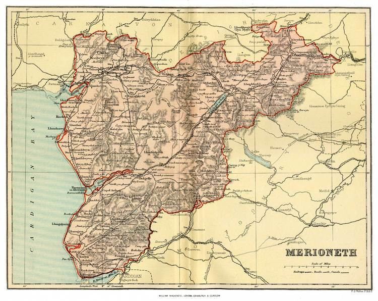
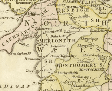
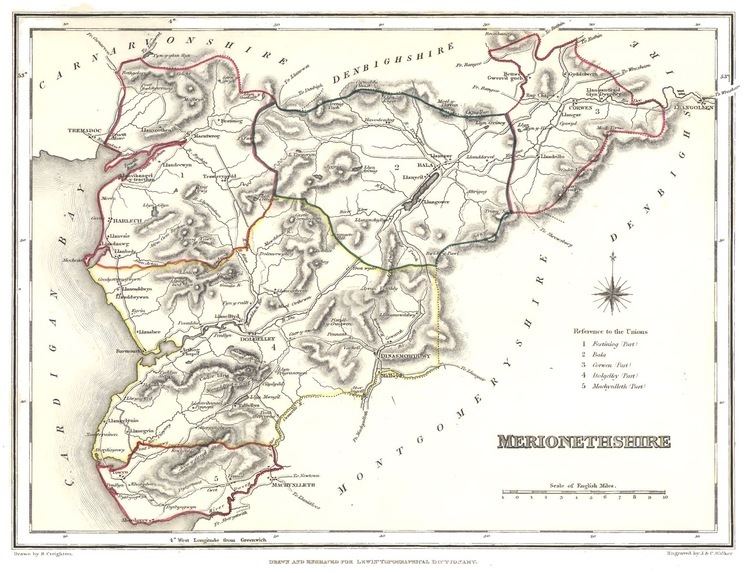
Merionethshire is a maritime county, bounded to the north by Caernarfonshire, to the east by Denbighshire, to the south by Montgomeryshire and Cardiganshire, and to the west by Cardigan Bay. With a total area of 1,731 km² (668 sq miles), it is one of the more sparsely populated counties in Great Britain.
The Merioneth area remains one of the strongest Welsh-speaking parts of Wales. The coastline consists alternately of cliffs and stretches of sand and the area generally is the most mountainous in Wales; a large part of the Snowdonia National Park lies within it. The greatest heights are Aran Fawddwy 905 m (2,970 ft) and Cadair Idris 893 m (2,929 ft). The chief rivers are the Dwyryd, the Mawddach and the Dyfi. Waterfalls and small lakes are numerous, the largest being Bala Lake (4 miles long and 1-mile (1.6 km) broad).
History
The county was formed in 1284 under the terms of the Statute of Rhuddlan from the Cantrefi of:
Merioneth was an important part of the Welsh slate industry in the nineteenth and twentieth centuries, with major quarrying centres at Blaenau Ffestiniog in the north of the county and Corris in the south.
Administration
An administrative county of Merioneth was created under the Local Government Act 1888 on 1 April 1889. The first election to the new authority was held in January 1889. The county was abolished under the Local Government Act 1972 on 1 April 1974. The bulk formed the Meirionnydd district of Gwynedd, with a small area in the north east, Edeirnion Rural District, becoming part of the Glyndŵr district of Clwyd.
As a result of the Local Government (Wales) Act 1994, which came into force on 1 April 1996, the Glyndŵr area was made a part of the new Denbighshire principal area, with the rest forming a new Caernarfonshire and Merionethshire principal area. The latter area was, however, renamed Gwynedd almost immediately.
Main towns
The main towns are
The main industries today are agriculture, forestry and tourism.