
Area 132 km² | Website www.meremae.ee Population 1,140 (1 Jan 2009) | |
 | ||
Meremäe Parish (Estonian: Meremäe vald) is a rural municipality of Estonia, in Võru County. It has a population of 1,140 (as of 1 January 2009) and an area of 131.97 km².
Contents
- Map of MeremC3A4e Parish VC3B5ru County Estonia
- Settlements
- Education
- Pre Soviet
- Soviet
- Post Soviet
- Religious Landmarks
- Landforms
- Other Landmarks
- Indigenous Species
- Entrepreneurship
- References
Map of Merem%C3%A4e Parish, V%C3%B5ru County, Estonia
Meremäe is a part of the cultural region of Setomaa.
Settlements
The following is a list of all of the reported villages and other settlements in the Parish: Ala-Tsumba – Antkruva – Ermakova – Härmä – Helbi – Hilana – Hilläkeste – Holdi – Ignasõ – Jaanimäe – Jõksi – Juusa – Kalatsova – Kangavitsa – Karamsina – Kasakova – Kastamara – Keerba – Kiiova – Kiislova – Kiksova – Kitsõ – Klistina – Kõõru – Korski – Kuigõ – Kuksina – Küllätüvä – Kusnetsova – Lepä – Lindsi – Lutja – Maaslova – Marinova – Martsina – Masluva – Melso – Merekülä – Meremäe – Miikse – Miku – Navikõ – Obinitsa – Olehkova – Ostrova – Paklova – Palandõ – Palo – Paloveere – Pelsi – Pliia – Poksa – Polovina – Puista – Raotu – Rokina – Ruutsi – Seretsüvä – Serga – Sirgova – Sulbi – Tääglova – Talka – Tedre – Tepia – Tessova – Teterüvä – Tiirhanna – Tiklasõ – Tobrova – Treiali – Triginä – Tsergondõ – Tsirgu – Tsumba – Tuplova – Tuulova – Ulaskova – Uusvada – Vaaksaarõ – Väiko-Härmä – Väiko-Serga – Vasla – Veretinä – Vinski – Viro – Võmmorski.
The larger villages are Meremäe (146 residents) and Obinitsa (135 residents). None of the other villages were reported to have more than 34 people living there in 2011.
Education
Obinitsa Kindergarten and Meremäe School which operate as a kindergarten/basic school are situated in the Meremäe municipality.
Pre-Soviet
Meremäe rural municipality was established on 23 May 1922. It belonged under Petseri County (Estonian: Petserimaa). Meremäe rural municipality was formed as a result of the administrative-territorial reform, in the course of which the four large municipalities of Petseri County were divided into 11 smaller ones. Meremäe rural municipality was initially called Obinitsa.
In 1922, on the 13th and 14 August the first elections of the rural municipality council took place. Nikolai Rammula was elected as the mayor of the rural municipality; Johan Tamm became the rural municipality secretary. The Rural Municipality Office was situated in the household of a family named Kärner in Põrste village. A new rural municipality building – Meremäe Town Hall, was built quite near to the geographical centre of the municipality, at the intersection of the historic Võru-Petseri and Pankjavitsa-Kiirova-Orava-Räpina roads. Today this building is used as Meremäe Youth Centre.
On 16 May 1923, Obinitsa rural municipality was renamed Meremäe rural municipality. New elections took place the same year, where the runners for the rural municipality council were districts by the names of "Krundimehed", "Mihailova District", "Mihailova and Vasilde Districts United" and "Obinitsa District" A total of 75 candidates were listed. Nikolai Rammula was re-elected for rural municipality mayor and Johan Tamm for secretary.
Soviet
During Soviet times, a system of different village councils existed on the rural municipality territory. Kalatsova, Obinitsa and Veretion each had a separate village council, and at first these were subordinates to the Meremäe Rural Municipality Executive Committee who, in turn, were subordinated to Võru County and later to the Executive Committee of the Vastseliina District. The Executive Committee of the rural municipality was later dissolved. Kalatsova Village Council was renamed to Meremäe Village Council, whilst Veretino Village Council was merged with Obinitsa and Meremäe. According to the agreement signed in August 1944 (which was supported by the central authorities of the Soviet Union), the Estonian Soviet Socialist Union government surrendered more than half of Petseri County to the Russian Federation. A significant part of that was from Meremäe rural municipality territory, including villages around Krantsova, Kiirova and Vasilde.
Post-Soviet
After the dissolution of Vastseliina District in 1959, they became part of the Võru District. On 3 September 1960, Meremäe Village Council was merged with what was then known as Illi Village Council (the villages from the Kapera, Möldre and Vana-Vastseliina area). The self-governing status of Meremäe rural municipality was reinstated on 5 March 1992. On 1 January 1998, control of the villages in Vastseliina parish was returned to Vastseliina rural municipality and the Meremäe rural municipality of today covers a region of 132 square kilometres, and has 87 smaller and larger villages of the historic Setomaa region. Meremäe rural municipality building has moved a number of times. Originally, the rural municipality office was situated in the household of the Kärner family in Põrste village. Later, the building for the rural municipality was built in Meremäe, however that building became Meremäe youth centre when the present rural municipality building was built in 1932.
Religious Landmarks
Churches:
Typical small Seto chapels (tsässon):
Almost all tsässonas in the Miikse and Viro villages are perished. The Viro stone cross is situated at the location of the Viro tsässon.
Burial grounds:
Other Sacred Places:
Landforms
Hills:
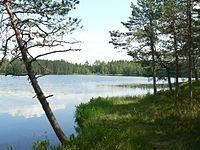
Rivers and lakes:
Caves and sandstone outcrops:
Springs:
Other Landmarks
Monuments and sculptures:
The monument to the Singing Mother of the Seto People stands on the high bank of Obinitsa artificial lake, modelled by sculptor E. Rebane, E. Taniloo in 1986. Memorial stones to other famous local singers of the area stand around the monument.
Parks:
Hiking trails:
Museums and culture centres:
Indigenous Species
The region has two indigenous species of pine, the Meremäe pines and the Tsirgu pine.
Entrepreneurship
The more important businesses in Meremäe rural municipality are operating in the fields of agriculture, tourism, creative industry and mining industry. Piusa Ancient Valley Holiday Complex and Setomaa Tourist Farm are the most notable tourism businesses. Marinova dolostone quarry is located within the rural municipality.