
Population 5,110 (2001 Census) Sovereign state United Kingdom Local time Sunday 3:29 AM Dialling code 0151 | OS grid reference SJ232900 Post town WIRRAL | |
 | ||
Weather 12°C, Wind SW at 31 km/h, 82% Humidity ISO 3166 code | ||
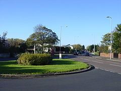
Meols drive
Meols /ˈmɛlz/ is a village on the northern coast of the Wirral Peninsula, England. It is contiguous with the larger town of Hoylake, situated immediately to the west. Historically in Cheshire, since 1 April 1974 it has been a part of the Metropolitan Borough of Wirral in the metropolitan county of Merseyside. The 2001 Census recorded the population of Meols as 5,110 (2,380 males, 2,730 females). The population of Meols was no longer recorded at the Census 2011. For more general statistics see Meols (Ward).
Contents
Map of Meols, Wirral, UK
History
Meols was named as such by the Vikings; its original name from the Old Norse for 'sand dunes' was melr, becoming melas by the time of the Domesday Survey.
Impressive archaeological finds dating back to the Neolithic period suggest that the site was an important centre in antiquity. Since about 1810, a large number of artefacts have been found relating to pre-Roman Carthage, the Iron Age, the Roman Empire, Armenia, the Anglo-Saxons and the Vikings. These include items as varied as coins which belonged to the Coriosolites in Brittany. Also, tokens, brooches, pins, knives, glass beads, keys, pottery, flint tools, mounts, pilgrim badges, pieces of leather, worked wood and iron tools. They came to be discovered after the beginning of large-scale dredging (to accommodate the needs of the nearby growing seaport of Liverpool) started to cause notable sand erosion along the coastline near Meols. These finds suggest that the site was used as a port as far back as the Iron Age some 2,400 years ago, and was once the most important seaport in the present-day North West England. Thus trading connections are believed to have reached far across Europe. Some of these artefacts are on display locally, at the Museum of Liverpool. In the 1890s the local authorities built the first sea wall. The rapidly eroding coastline was saved, but the sea wall changed the currents and archaeological sites at Meols were buried in the sand. The remains of a submerged forest off Dove Point have now also disappeared but they were visible until the spring of 1982.
On 10 September 2007, Professor Stephen Harding of the University of Nottingham, used ground penetrating radar (GPR) equipment to pinpoint the location of a 1,000-year-old Viking transport longship (Nordic clinker design) beneath 2–3 m (6–10 feet) of clay in Meols. The ship had been previously uncovered in 1938 during excavations for a car park. Workers at the time covered the ship over again so as not to delay construction.
Meols was formerly called Great Meols. It was a township in West Kirby Parish of the Wirral Hundred, becoming part of Hoylake cum West Kirby civil parish in 1894. Great Meols had a population of 140 in 1801, 170 in 1851 and 821 in 1901. The name Great Meols survives in the name of the primary school and the Anglican church. It was still in more general use up to the 1960s, for instance in postal addresses and on the destination indicators of buses from Chester, but not as the name of the railway station.
There also used to be a village called Little Meols, on Meols Drive between Hoylake and West Kirby The name Little Meols fell out of use in Victorian times, having been absorbed by Hoylake. From 123 inhabitants in 1801 and 170 in 1851, by 1901 at 2,850, its population had outstripped Great Meols.
Meols was known to be spelt as Meolse up until when the railway station was placed. The error came about at the time of the station's construction, when rail managers took the spelling of Meols from the Southport suburb of Meols Cop and used it for new signage.
Description
Meols is mainly residential with a small yacht and fishing community on its Irish Sea shore line. The centre has a small row of shops adjacent to Meols railway station. There is a local community park known as Meols Park Recreation Ground and a Meols bowling green. The Friends of Meols Park are a community group set up in 2007 to help maintain and improve the recreation ground.
It was home to the cyclist Chris Boardman, winner of a gold medal for Great Britain at the 1992 Summer Olympics, before he moved to Hoylake.
In the 1930s a clinker-built boat was discovered in rebuilding the Railway Inn public house. After confirmation of its discovery by local police constable, Tim Baldock, ground-penetrating radar equipment was used in September 2007 to confirm the existence of the boat. The vessel is believed to be lying beneath approximately 6 ft to 10 ft (2m to 3m) of clay. Professor Stephen Harding, of the University of Nottingham, is seeking funds for an excavation and removal to a museum.
Transport
Rail
Bus
A number of school services also serve Meols, which are dedicated for schools & colleges in the Wirral.