
Country United States County Dunn Area code(s) 715 & 534 Population 16,264 (2010) | Time zone Central (CST) (UTC-6) Website www.menomonie-wi.gov Local time Saturday 8:47 PM | |
 | ||
Weather -1°C, Wind NE at 5 km/h, 79% Humidity Area 40.07 km² (35.46 km² Land / 4.61 km² Water) University | ||
Menomonie is a city in and the county seat of Dunn County in the western part of the U.S. state of Wisconsin. The city's population was 16,264 as of the 2010 census.
Contents
- Map of Menomonie WI 54751 USA
- Lake menomin waterfront house for sale private 4 5 acre lakefront estate menomonie wisconsin
- History
- Geography
- 2010 census
- 2000 census
- Transportation
- Education
- Media
- Honors
- In popular culture
- References
Map of Menomonie, WI 54751, USA
Named for the historic Native American tribe, the Menominee, inhabitants who pre-dated the state, the city forms the core of the United States Census Bureau's Menomonie Micropolitan Statistical Area, which includes all of Dunn County (2010 population: 43,857). The Menomonie MSA and the Eau Claire metropolitan area to the east form the Census Bureau's Eau Claire-Menomonie Consolidated Metropolitan Statistical Area.
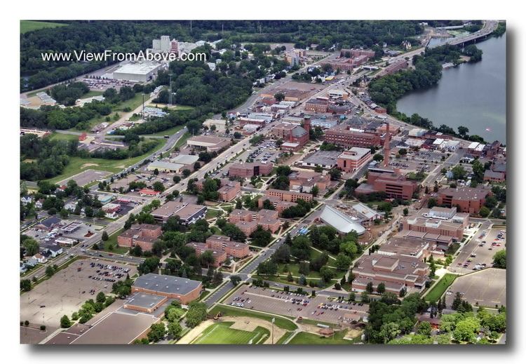
The city center is located at the south end of Lake Menomin, a reservoir on the Red Cedar River.
Lake menomin waterfront house for sale private 4 5 acre lakefront estate menomonie wisconsin
History
The earliest known residents of the area were people from the Trempealeau Hopewell Culture of the Middle Woodland Period (1-400 AD). Evidence from their culture includes a mound from the Wakanda Mounds Group in Wakanda Park, along the western shore of Lake Menomin. Most of these mounds are thought to be from Effigy Mound cultures from this time period. Artifacts from the Late Woodland Period (400-1000 AD) have also been uncovered. It is theorized that agricultural villages supported the population during summer months, transitioning to hunting and gathering from fall through spring. The next known population group is the Santee Dakota in the 1600s and 1700s, who engaged in conflicts with the Ojibwe people, who migrated west as refugees. Armed with European weapons, the Ojibwe pushed westward, eventually winning at the Battle of Kathio in 1770. The two tribes continued their warfare, eventually signing the 1825 First Treaty of Prairie du Chien, which made a border between the two just north of Menomonie, with the Dakota claiming the southern lands.
In 1788, French-Canadian fur trader and schoolmaster Jean Baptiste Perrault established a trading post and fort on the Red Cedar River very near Menomonie.
The lumber industry brought Menomonie permanent settlement and economic prosperity in the 1800s. The Wisconsin Milling Company set up shop at the confluence of Wilson Creek and the Red Cedar River, which was purchased by Hardin Perkins, backing fur traders James H. Lockwood and Joseph Rolette in 1822 and subsequently washed away by a sudden overflow in the river. Working with Indian Agent General Street, Perkins, Lockwood and Rolette began a legal battle over the authority of the local Native American people to grant permissions of this sort, exchanging land for payment of blankets, beads, whiskey, and other merchandise to Chief Wabashaw and the other Ojibwe chiefs. In 1830 they received permission from the federal government to rebuild their lumber operation. This was the first permanent settlement on the land that became the city of Menomonie.
Lockwood built a second mill and dam on the west side of the Red Cedar River, at the confluence of Gilbert Creek. He sold this to Hiram S. Allen, a lumberman from Vermont. In 1839, Hiram S. Allen built a new sawmill in its place, which he sold to the McCann brothers, settlers from Ohio who later became the first permanent residents of Eau Claire. In 1849, the Gilbert Creek Mill became the site of the first post office.
Lockwood and Rolette sold their original operation to James Green in 1841, who turned over the deed to William Black in 1842. In 1846, William Wilson and John Holly Knapp jointly purchased the mill, naming it Black & Knapp Mill. Wilson and his family settled in the area, eventually building what is now the Wilson Place Museum in 1859. Wilson founded the city of Menomonie and became its first mayor, as well as a Wisconsin State Senator.
Captain Andrew Tainter and Henry L. Stout acquired ⅓ interest in Wilson and Knapp's company, forming Knapp, Stout & Co. in 1853, the company that would come to define the town for generations. Tainter was a silent partner, whose duties included shipping lumber down to the Mississippi River and returning with supplies. By 1873, Knapp, Stout & Co. had grown into the largest lumber corporation in the world. In 43 years, its output grew from 100,000 to 5,706,602 feet of lumber. It had 1,200 employees and owned 115,000 acres (47,000 ha) of pine forest. The post office was moved to the site of the Knapp, Stout & Co. Company in 1855, with Wilson as postmaster.
Menomonie was incorporated as a city in 1882.
The Mabel Tainter Memorial Building, a local landmark, was built in 1890 by Tainter in honor of his daughter Mabel, who had died in 1886 at the age of 19. In 1891, Wisconsin State Senator James Huff Stout, son of Henry L. Stout, founded a manual training school, the first of several educational enterprises he launched in Menomonie. These educational programs were combined into the Stout Institute in 1908, and still stand as the University of Wisconsin–Stout.
In 1901, the water mill shut down and Knapp, Stout & Co. closed operations in the area. The Wisconsin Power Company and Submerged Electric Motor Co. acquired some of the company's facilities, the latter to house the world's first outboard motor factory. In 1902, the Wilson-Weber Lumber Company took over retail operations of the Knapp, Stout & Co. That same year, Menomonie founded the first agricultural high school in the United States, the Dunn County School of Agriculture and Domestic Economy.
Geography
Menomonie is located at 44°52′45″N 91°55′5″W (44.879336, -91.918333).
According to the United States Census Bureau, the city has a total area of 15.47 square miles (40.07 km2), of which, 13.69 square miles (35.46 km2) is land and 1.78 square miles (4.61 km2) is water.
2010 census
As of the census of 2010, there were 16,264 people, 5,743 households, and 2,455 families residing in the city. The population density was 1,188.0 inhabitants per square mile (458.7/km2). There were 6,234 housing units at an average density of 455.4 per square mile (175.8/km2). The racial makeup of the city was 91.9% White, 0.8% African American, 0.5% Native American, 4.2% Asian, 0.6% from other races, and 1.9% from two or more races. Hispanic or Latino of any race were 1.7% of the population.
There were 5,743 households of which 20.1% had children under the age of 18 living with them, 30.9% were married couples living together, 8.4% had a female householder with no husband present, 3.4% had a male householder with no wife present, and 57.3% were non-families. 36.1% of all households were made up of individuals and 12.7% had someone living alone who was 65 years of age or older. The average household size was 2.26 and the average family size was 2.87.
The median age in the city was 23.4 years. 13.4% of residents were under the age of 18; 42% were between the ages of 18 and 24; 18.5% were from 25 to 44; 14.9% were from 45 to 64; and 11% were 65 years of age or older. The gender makeup of the city was 49.5% male and 50.5% female.
2000 census
As of the 2000 census, there were 14,937 people, 5,119 households, and 2,370 families residing in the city. The population density was 1,160.7 people per square mile (448.1/km²). There were 5,441 housing units at an average density of 422.8 per square mile (163.2/km²). The racial makeup of the city was 93.79% White, 0.76% Black or African American, 0.41% Native American, 3.21% Asian, 0.01% Pacific Islander, 0.64% from other races, and 1.18% from two or more races. 1.14% of the population were Hispanic or Latino of any race.
There were 5,119 households out of which 22.6% had children under the age of 18 living with them, 36.0% were married couples living together, 7.5% had a female householder with no husband present, and 53.7% were non-families. 32.7% of all households were made up of individuals and 11.1% had someone living alone who was 65 years of age or older. The average household size was 2.35 and the average family size was 2.95.
In the city, the population was spread out with 15.5% under the age of 18, 40.4% from 18 to 24, 20.5% from 25 to 44, 12.3% from 45 to 64, and 11.3% who were 65 years of age or older. The median age was 23 years. For every 100 females there were 99.1 males. For every 100 females age 18 and over, there were 98.6 males.
The median income for a household in the city was $31,103, and the median income for a family was $44,458. Males had a median income of $30,893 versus $21,898 for females. The per capita income for the city was $15,994. About 9.1% of families and 23.5% of the population were below the poverty line, including 16.7% of those under age 18 and 7.3% of those age 65 or over.
Transportation
Menomonie Municipal Airport (KLUM) serves the city and surrounding communities.
Education
Menomonie is served by Menomonie High School.
The city is the home of the University of Wisconsin–Stout and a campus of Chippewa Valley Technical College.
Media
Honors
Menomonie was ranked #15 in Smithsonian Magazine's "The 20 Best Small Towns in America" in 2012.