
Founded 1857 Area 2,238 km² | Named for Charles Dunn Website www.co.dunn.wi.us Population 44,122 (2013) Unemployment rate 4.2% (Apr 2015) | |
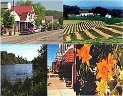 | ||
Points of interest | ||
Dunn County is a county in the U.S. state of Wisconsin. As of the 2010 census, the population was 43,857. Its county seat is Menomonie.
Contents
- Map of Dunn County WI USA
- History
- Geography
- Adjacent counties
- Airports
- Demographics
- City
- Villages
- Census designated places
- Ghost towns
- References
Map of Dunn County, WI, USA
Dunn County comprises the Menomonie, WI Micropolitan Statistical Area and is included in the Eau Claire-Menomonie, WI Combined Statistical Area.
History
The county was founded in 1854 from Chippewa County and organized in 1857. It is named for Charles Dunn, first chief justice of the territory.
Geography
According to the U.S. Census Bureau, the county has a total area of 864 square miles (2,240 km2), of which 850 square miles (2,200 km2) is land and 14 square miles (36 km2) (1.6%) is water.
Adjacent counties
Airports
Demographics
As of the census of 2000, there were 39,858 people, 14,337 households, and 9,261 families residing in the county. The population density was 47 people per square mile (18/km²). There were 15,277 housing units at an average density of 18 per square mile (7/km²). The racial makeup of the county was 96.08% White, 0.34% Black or African American, 0.27% Native American, 2.13% Asian, 0.01% Pacific Islander, 0.37% from other races, and 0.80% from two or more races. 0.84% of the population were Hispanic or Latino of any race. 39.3% were of German, 22.6% Norwegian and 5.1% Irish ancestry according to Census 2000. 95.7% spoke English, 1.6% Spanish and 1.5% Hmong as their first language.
There were 14,337 households out of which 31.40% had children under the age of 18 living with them, 54.10% were married couples living together, 6.90% had a female householder with no husband present, and 35.40% were non-families. 24.40% of all households were made up of individuals and 9.00% had someone living alone who was 65 years of age or older. The average household size was 2.57 and the average family size was 3.07.
In the county, the population was spread out with 23.30% under the age of 18, 19.80% from 18 to 24, 25.70% from 25 to 44, 19.80% from 45 to 64, and 11.20% who were 65 years of age or older. The median age was 31 years. For every 100 females there were 101.70 males. For every 100 females age 18 and over, there were 102.20 males.