
Topo map USGS Lemon Gap Prominence 259 m | Elevation 1,407 m Parent range Bald Mountains | |
 | ||
Location Madison County, North Carolina, U.S. Mountain range Blue Ridge Mountains, Bald Mountains Similar Roan Mountain, Clingmans Dome, Charlies Bunion, Mount Cammerer, Black Balsam Knob | ||
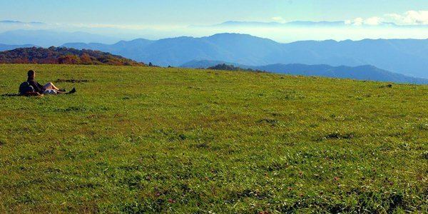
Max patch mountain 360 degree panorama on appalachian trail
Max Patch is a bald mountain on the North Carolina-Tennessee Border in Madison County, North Carolina and Cocke County, Tennessee. It is a major landmark along the Tennessee/North Carolina section of the Appalachian Trail, although its summit is located in North Carolina. It is known for its 360 degree views of the surrounding mountains, namely the Bald Mountains in the immediate vicinity, the Unakas to the north, the Great Smokies to the south, and the Great Balsams and Black Mountains to the southeast. A small parking area is located near the summit with a short loop trail.
Contents
- Max patch mountain 360 degree panorama on appalachian trail
- Map of Max Patch 8 Spring Creek NC 28743 USA
- Road to max patch nc
- References
Map of Max Patch, 8, Spring Creek, NC 28743, USA
Road to max patch nc
References
Max Patch Wikipedia(Text) CC BY-SA