
OS grid reference TF361663 Local time Wednesday 6:32 PM | Sovereign state United Kingdom Postcode district PE23 | |
 | ||
Weather 11°C, Wind S at 6 km/h, 69% Humidity | ||
Mavis Enderby is a hamlet and civil parish in the East Lindsey district of Lincolnshire, England. It lies in the Lincolnshire Wolds, 4.5 miles (7 km) east from Horncastle. The population is included in the civil parish of Raithby by Spilsby.
Contents
Map of Mavis Enderby, Spilsby, UK
History
An alternative spelling may be "Malvyssh Enderby", as seen in a legal record in 1430, where the plaintiffs are the executors of a man whose surname is Enderby, and the defendant lives in Malvyssh Enderby.
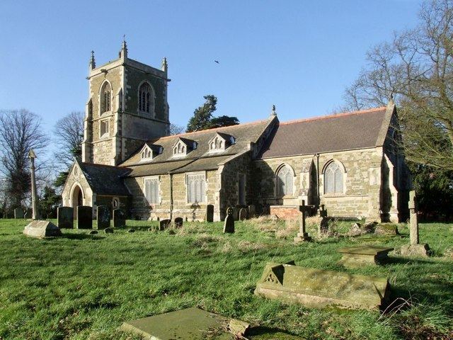
St Michael's Church
The parish church is dedicated to St Michael. Dating from the 14th and 15th centuries, the church was restored by James Fowler 1875. The tower was rebuilt by C. Hodgson Fowler in 1894. The exterior is of squared greenstone rubble, with limestone ashlar dressings. It has Welsh and Westmorland slate roofs with decorative tiled ridges. The church interior comprises a nave, western tower, south aisle and porch, and a chancel. At the threshold of west door to the tower is set part of a coped or round-topped 11th century Saxon grave slab, possibly placed here in 1894. The churchyard has the remains of a 14th-century churchyard cross.
In the porch is a Norman pillar piscina, a stone basin for draining water used in the rinsing of the chalice. The churchyard has a sundial erected by a former rector.