
INSEE/Postal code 78383 /78310 Area 8.31 km² Local time Wednesday 4:40 PM | Region Île-de-France Time zone CET (UTC+1) Elevation 87–178 m (285–584 ft) Population 18,789 (2007) | |
 | ||
Weather 14°C, Wind NE at 10 km/h, 64% Humidity | ||
Maurepas is a commune in the Yvelines department in the Île-de-France region in north-central France. It is located in the western suburbs of Paris 31.2 km (19.4 mi) from the center.
Contents
Map of 78310 Maurepas, France
Twin towns
It is twinned with Waterlooville in Hampshire, UK.
History
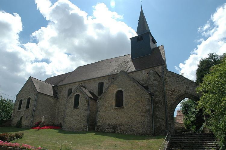
Most ancient buildings are the ruins of the donjon, built in 11th century and destroyed in 1425. There is also near St Sauveur's church, dating of the 15th century.
Transportation
Maurepas is served by no station of the Paris Métro, RER, or suburban rail network. The closest station to Maurepas is La Verrière station on the Transilien La Défense and Transilien Paris – Montparnasse suburban rail lines. This station is located in the neighboring commune of La Verrière, 0.7 km (0.43 mi) from the town center of Maurepas.
Education
Junior high schools:
Collège de la Mare aux Saules is in nearby Coignières.
Senior high schools/sixth-form colleges: