
Carries Motor vehicles | ||
 | ||
Similar Tauranga Harbour, ASB Baypark Stadium, Classic Flyers Museum, Mount Maunganui, Motiti Island | ||
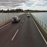
Sh29a maungatapu bridge
The Maungatapu Bridge is a beam bridge which crosses the Tauranga Harbour and connects the Matapihi and Maungatapu peninsulas in New Zealand. The bridge opened in 1959 and is 316 metres long and 10 metres wide. The bridge carries two lanes of traffic and a footpath. Prior to 2009 State Highway 2 and State Highway 29 ran concurrently over the bridge. Following the completion of the Harbour Link project, State Highway 2 was diverted over the Tauranga Harbour Bridge, so at the present time only State Highway 29 runs over the bridge.
References
Maungatapu Bridge Wikipedia(Text) CC BY-SA