
Prominence 70 m (230 ft) OSI/OSNI grid O184130 Elevation 570 m | Topo map OSi Discovery 56 Province Leinster | |
 | ||
Similar Djouce, Tonelagee, Seefingan, Two Rock, Tibradden Mountain | ||
Maulin naker bomby prod skodiss
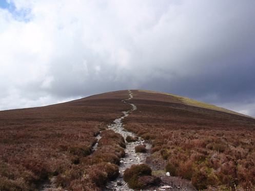
Maulin (Irish: Málainn, meaning "High or sloping ground") is a hill located in the northeastern section of the Wicklow Mountains, close to the border with County Dublin.
Contents
- Maulin naker bomby prod skodiss
- Map of Maulin Crone Co Wicklow Ireland
- Maulin tokyo shot by belxch
- Access to the summit
- References
Map of Maulin, Crone, Co. Wicklow, Ireland
Maulin tokyo shot by belxch
Access to the summit
The mountain can be found on a side trail off the main Wicklow Way. It is readily accessible via well-marked trails from Crone Wood carpark, located south-west of Enniskerry. The summit offers spectacular views of the northern part of the Wicklow hills, including The Great Sugar Loaf and Djouce Mountain.
The route to the summit is waymarked for the use of hillwalkers.
Knockree An Óige youth hostel is located just below the summit.
Much of the north face is forested with a Sitka spruce plantation, known as Crone Wood.
References
Maulin Wikipedia(Text) CC BY-SA