
Surface area 1.76 km (0.68 sq mi) Surface elevation 2,197 m Length 3.2 km | Max. length 3.2 km (2.0 mi) Max. depth 93 m (305 ft) Area 176 ha Catchment area 37.1 km² | |
 | ||
Similar Saastal, Allalin Glacier, Alps, Monte Moro Pass, Britannia Hut | ||
Mattmarksee am 4 9 2013
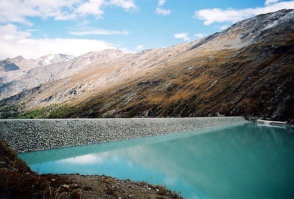
Mattmark dam is a reservoir in the Saas Valley of the Canton of Valais, Switzerland. The Mattmark dam was built from 1960-1965. The lake's surface area is 1.76 km2 (0.68 sq mi).
Contents
- Mattmarksee am 4 9 2013
- Map of Mattmarksee 3905 Saas Almagell Switzerland
- Mattmarksee saas fee hd mov
- References
Map of Mattmarksee, 3905 Saas-Almagell, Switzerland
The lake lies at a height of 2,197 metres above sea level, between the massifs of the Rimpfischhorn and Stellihorn. The highest peak visible from the lake is the Strahlhorn (4,190 m).
Mattmarksee saas fee hd mov
References
Mattmarksee Wikipedia(Text) CC BY-SA