Harman Patil (Editor)

Matsumae District, Hokkaido

Updated on
Edit
Like
Comment
Share on FacebookTweet on TwitterShare on LinkedInShare on Reddit
Matsumae District, Hokkaido

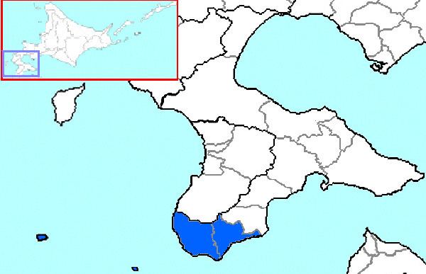
Matsumae (松前郡, Matsumae-gun) is a district located in southwestern Oshima Subprefecture, Hokkaido, Japan.

Contents

Map of Matsumae District, Hokkaido Prefecture, Japan

As of 2004, the district has an estimated population of 16,068 and a density of 33.45 persons per km². The total area is 480.32 km².

Towns

  • Fukushima
  • Matsumae
  • History

  • 1869 With the establishment of provinces and Districts in Hokkaido, Tsugaru District (identical to modern Matsumae Town) and Fukushima District (identical to modern Fukushima Town and Shiriuchi in Kamiiso District) were set up.
  • 1871—1872 Placed under Hirosaki Prefecture and Aomori Prefecture.
  • 1881 Shiriuchi Village and Shōkokuishi?? Village (小谷石村) (split off from Fukushima Village) transferred to Kamiiso District. The remaining area of Fukushima District and Tsugaru District were merged to form Matsumae District.
  • 1897 Matsumae Subprefecture established containing only Matsumae District.
  • 1903 Matsumae Subprefecture merged with Hakodate Subprefecture (later renamed Oshima Subprefecture).
  • Geography

    The district is located on the southern end of the Matsumae Peninsula. The district includes the two islands in the Tsugaru Strait, Oshima and Kojima.

    References

    Matsumae District, Hokkaido Wikipedia