
Post code 049-1592 Population 9,568 (31 Mar 2009) | Area code(s) 0139 Local time Wednesday 6:02 PM | |
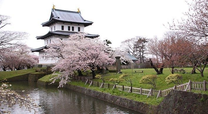 | ||
Weather 3°C, Wind NW at 11 km/h, 66% Humidity Points of interest Matsumae Castle, Matsumae Park, Kozenji, Matsumae Clan Mansion, Cape Shirakami | ||
Matsumae (松前町, Matsumae-chō) is a town located in Matsumae District, Oshima Subprefecture, Hokkaido, Japan. The former home of the Matsumae Han, it has an Edo period castle, Matsumae Castle, the only one in Hokkaido, and Ryūun-in.
Contents
- Map of Matsumae Matsumae District Hokkaido Prefecture Japan
- Geography
- Demographics
- History
- High school
- Sister cities
- References
Map of Matsumae, Matsumae District, Hokkaido Prefecture, Japan
The total area of the town is 293.11 square kilometres (113.17 sq mi).
Geography
The town is located on the southern end of the Matsumae Peninsula. In addition the town governs the two islands in the Tsugaru Strait, Oshima and Kojima.
Demographics
As of September 2016, the town has an estimated population of 7,843 and a density of 26.7 persons per km².
History
High school
Sister cities
References
Matsumae, Hokkaido Wikipedia(Text) CC BY-SA