
Highest point Les Suvières | Country France | |
 | ||
Mountains Pic d'Aurelle, Cap Roux, Pic de l'Ours, Les Suvières, Rastel d'Agay Similar Lérins Islands, French Riviera, Île d'Or, Argens, Lac de Saint‑Cassien | ||
Massif de l esterel
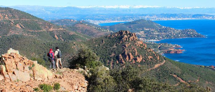
The Esterel Massif (in Occitan Provençal: Esterèu; French: Massif de l'Esterel) is a Mediterranean coastal mountain range in the departments of Var and Alpes-Maritimes in Provence, south-east France.
Contents
- Massif de l esterel
- Map of Massif de lEsterel 83600 FrC3A9jus France
- Massif de l esterel sud france vortex fpv
- References
Map of Massif de l'Esterel, 83600 Fr%C3%A9jus, France
Neighbouring cities are Mandelieu and Cannes on the east and Saint-Raphaël / Fréjus on the west.
The soil and rocks of the range are of volcanic origin, composed mainly of porphyry, which gives the hills a red color. The terrain is rugged, with deep ravines and oak forests. The highest point of the massif is Mont Vinaigre (618 metres).
The massif covers an area of 320 km², of which 130 km² are officially protected in the Forêt domaniale de l'Esterel (National Forest of Esterel). The nature reserve offers hiking and mountain biking trails including the GR 49 and GR 51. The Esterel mountains also host the Pierre et Vacances holiday village Cap Estérel.