
Area 72 ha | ||
 | ||
Similar Figure Eight Island, Carolina Beach State Park, Fort Fisher State Recreatio, Currituck Banks North Car, Airlie Gardens | ||
Kayak eco tour
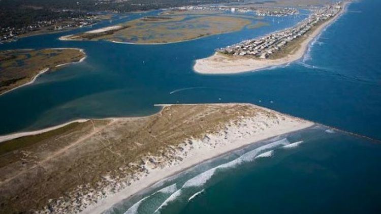
Masonboro Island is a barrier island in New Hanover County, North Carolina. The island, which is undeveloped and accessible only by boat, is a component of the North Carolina National Estuarine Research Reserve and a North Carolina State Natural Area. It lies south of Wrightsville Beach, separated by Masonboro Inlet, and north of Carolina Beach, separated by Carolina Beach Inlet. The island is a destination for boating, surfing, and camping.
Contents
- Kayak eco tour
- Map of Masonboro Island North Carolina USA
- Go with the flow masonboro island wrightsville beach
- References
Map of Masonboro Island, North Carolina, USA
Masonboro Island is a mix of marshes, dunes and tidal flats, with beaches along its Atlantic coastline and a chain of small hills and wetland islands along Masonboro Sound, which is part of the Intracoastal Waterway. The beaches are a nesting ground for loggerheads and green sea turtles, and the waters on the sound side of the island are a nursery for spot, mullet, flounder and pompano.