Length 193 mi (311 km) Designation National Recreation Trail | Use Hiking | |
 | ||
Trailheads South: Appalachian Trail at Whiskey Springs, PennsylvaniaNorth: Brandywine Creek at Chadds Ford, Pennsylvania | ||
Mason dixon trail hike gopro
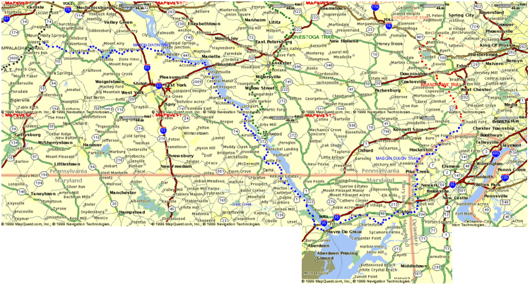
The Mason-Dixon Trail is a 195.9-mile (315.3 km), blue-blazed footpath that connects the Appalachian Trail with the Brandywine Trail, passing through Gifford Pinchot State Park and White Clay Creek Preserve in Pennsylvania and White Clay Creek State Park in Delaware. About 30 per cent of the "trail" is a route marked along public roads; the remainder is actual trail.
Contents
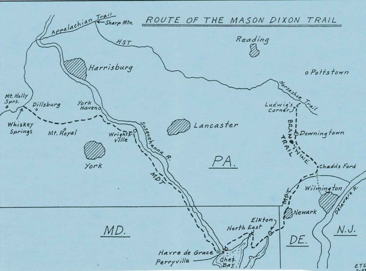
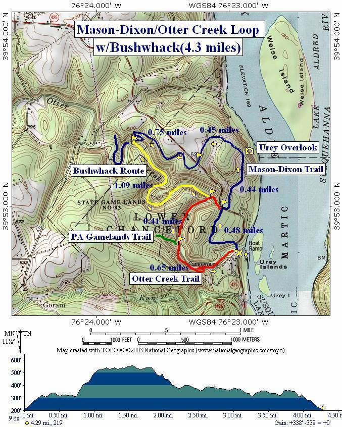
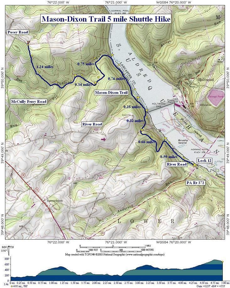
The trail starts near Mount Holly Springs at Whiskey Springs on the Appalachian Trail, in Cumberland County, Pennsylvania. It then heads east towards the Susquehanna River, passing through Gifford Pinchot State Park. The trail then follows the west bank of the Susquehanna south, first to Wrightsville, Pennsylvania, and then to Havre de Grace, Maryland. In the 65-mile (105 km) section between Wrightsville and Havre de Grace, it passes Long Level, Holtwood Dam, Susquehanna and Tidewater Canal Lock 12, Peach Bottom, and Conowingo Dam. The trail then crosses the Susquehanna River, passes through Elk Neck State Park, and crosses the border between Maryland and Delaware. After heading northeast through Newark, Delaware, the Mason-Dixon Trail ends at Chadds Ford on the banks of Brandywine Creek near the Delaware border.
Mason dixon trail york county pa apollo park to long level