
Israeli Subdistrict Golan | ||
 | ||
Weather 10°C, Wind W at 21 km/h, 77% Humidity | ||
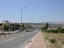
Mas'ade (Arabic: مسعدة, Hebrew: מַסְעַדֶה) is a Druze village in the northern Golan Heights. It covers an area of 11,985 dunams, and in 2015 had a population of 3,520. It was given the status of a local council in 1982. Its inhabitants are mostly Syrian citizens and have permanent residency in Israel. Since the adoption of the 1981 Golan Heights Law, Mas'ade is under Israeli civil law, and incorporated into the Israeli system of local councils.
Map of Mas'ada
Mas'ade is one of the four remaining Druze-Syrian communities on the Israeli-occupied side of the Golan Heights and on Mount Hermon, together with Majdal Shams, Ein Qiniyye and Buq'ata. Geographically a distinction is made between the Golan Heights and Mount Hermon, the boundary being marked by the Sa'ar Stream; however, administratively usually they are being lumped together. Mas'ade and Buq'ata are on the Golan side of the boundary, characterised by black volcanic rock (basalt), while Majdal Shams and Ein Qiniyye are on the Hermon side, thus sitting on limestone.
Near Mas'ade are Lake Ram and Odem Forest.
Mas'ade is located at the intersection of Route 99, which leads west to Kiryat Shmona, and Route 98, which leads north to Mount Hermon and south to the Kinneret (Sea of Galilee/Lake Tiberias).