
Existed: 1927 – present Counties: Kent Constructed 1927 | Length 5.36 km | |
 | ||
East end: Long Cove Public Landing near Crosby | ||
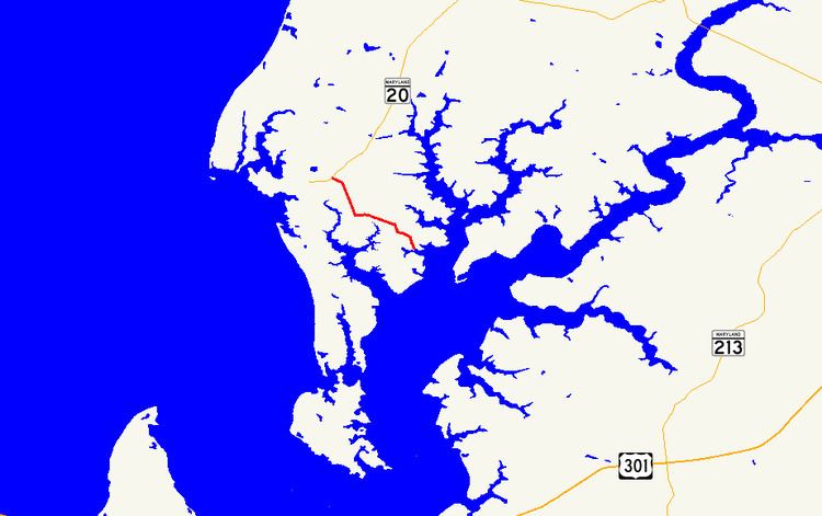
Maryland Route 288 (MD 288) is a state highway in the U.S. state of Maryland. Known as Crosby Road, the highway runs 3.33 miles (5.36 km) from MD 20 near Rock Hall east to Long Cove Public Landing on the Piney Neck peninsula near Crosby in western Kent County. MD 288 was constructed in the mid-1920s and resurfaced in the mid-1960s.
Contents
Map of MD-288, Rock Hall, MD 21661, USA
Route description
MD 288 begins at an intersection with MD 20 (Rock Hall Road) just east of Rock Hall. The two-lane highway heads south along Piney Neck between Grays Inn Creek to the west and Langford Creek to the east. At Skinners Neck Road, MD 288 turns east and then south again at Edesville Road. The highway turns east again in the hamlet of Crosby while Piney Neck Road continues south. MD 288 veers south while McKinleyville Road continues southeast. The highway reaches its eastern terminus at Long Cove Public Landing on Long Cove, an inlet of Langford Creek just north of where the creek empties into the Chester River.
History
MD 288 was constructed as a 9-foot-wide (2.7 m) concrete road from Coleman's Corner on the Rock Hall–Chestertown road to Crouch's Wharf on Piney Neck in 1925 and 1926. MD 288 was resurfaced with bituminous concrete in 1965.
Junction list
The entire route is in Kent County.