
Existed: 1927 – present Counties: Prince George's Constructed 1927 | Length 2.64 km | |
 | ||
County | ||
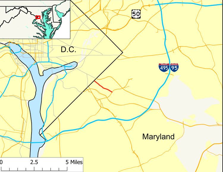
Maryland Route 218 (MD 218) is a state highway in the U.S. state of Maryland. Known as Suitland Road, the highway runs 1.64 miles (2.64 km) from Southern Avenue at the District of Columbia boundary east to MD 458 in Suitland. MD 218 provides access to the Suitland Federal Center, which is home to the U.S. Census Bureau. The state highway was constructed in the late 1920s and widened in the early 1940s and again in the late 1940s. The county portion of Suitland Road was reconstructed by the state in the mid-1950s.
Contents
Map of MD-218, Suitland, MD 20746, USA
Route description
MD 218 begins at Southern Avenue at the District of Columbia boundary. Suitland Road continues west into Washington to an intersection with Alabama Avenue in the Fairfax Village neighborhood. MD 218 heads southeast as a two-lane road between apartment complexes and crosses Oxon Run. The highway passes between Cedar Hill Cemetery to the north and Lincoln Memorial and Washington Memorial cemeteries to the south. East of the cemeteries, MD 218 gains a center turn lane and passes between Suitland Manor neighborhood on the north and Suitland Federal Center on the south; the federal center's main tenant is the U.S. Census Bureau. The state highway reaches its eastern terminus in the center of Suitland at MD 458 (Silver Hill Road). Suitland Road continues southeast as a county highway through a diamond interchange with Suitland Parkway, the town of Morningside, and a half-diamond interchange with the Capital Beltway to its terminus at MD 337 (Allentown Road) on the edge of Andrews Air Force Base.
History
MD 218, which has also been known as Cedar Hill Cemetery Road and River Road, was constructed as a 15-to-16-foot-wide (4.6 to 4.9 m) concrete road from the District of Columbia boundary to the east end of the Cedar Hill Cemetery grounds in 1926. The concrete highway was extended to the center of Suitland at MD 458 by 1930. By 1934, the highway was proposed to be widened to 20 feet (6.1 m) for its whole length. The first round of widening of MD 218 took place when a pair of 3.5-foot-wide (1.1 m) bituminous shoulders were added from the District to the east end of the cemetery grounds between 1938 and 1940 and from there to Suitland between 1940 and 1942. In addition, the highway's one-lane bridge across Oxon Run was replaced with the present bridge in 1940 and 1941. MD 218 was widened a second time, this time to a minimum width of 36 feet (11 m) for its whole length, in 1949 and 1950. The county-maintained portion of Suitland Road, which was also known as Mayhew Road and has never been part of MD 218, was reconstructed and paved by the Maryland State Roads Commission in two sections from MD 458 to Suitland Parkway and from the parkway to MD 337 at Andrews Air Force Base in 1954.
Junction list
The entire route is in Suitland, Prince George's County.