
Existed: 1927 – present Length 8.56 km | Counties: Montgomery Constructed 1927 | |
 | ||
North end: MD 355 in North Bethesda | ||
Maryland Route 187 (MD 187) is a state highway in the U.S. state of Maryland. Known as Old Georgetown Road, the highway runs 5.32 miles (8.56 km) from MD 355 and MD 410 in Bethesda north to MD 355 in North Bethesda. MD 187 is a four- to six-lane highway that runs parallel to MD 355 through suburban areas of southern Montgomery County. The highway was paved through Bethesda by 1910. The remainder of MD 187 was constructed in the mid- to late 1920s. The highway was relocated at its northern end and expanded to a divided highway over most of its length in the late 1960s. MD 187's interchanges with Interstate 270 and I-495 were built in the late 1950s and early 1960s, respectively; the former interchange was reconstructed in the early 2000s.
Contents
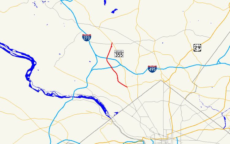
Map of MD-187, Maryland, USA
Route description
MD 187 begins at an intersection with MD 355 (Wisconsin Avenue) and westbound MD 410 (East–West Highway) next to the Bethesda station of the Washington Metro in downtown Bethesda. The state highway heads northwest as a two-lane one-way street to Woodmont Avenue. Southbound MD 187 traffic is required to turn north or south onto Woodmont Avenue. Woodmont Avenue, which becomes a southbound one-way street at the intersection, leads to Montgomery Lane, which provides access to MD 355 and eastbound MD 410 (Montgomery Avenue). MD 187 heads northwest from Woodmont Avenue as a four-lane highway with center turn lane that passes through a five-way intersection with MD 188 (Wilson Lane), Arlington Road, and St. Elmo Avenue and leaves downtown Bethesda. The state highway veers north and becomes a six-lane divided highway north of Huntington Parkway at Suburban Hospital, which sits opposite the southern end of the National Institutes of Health campus. MD 187 intersects several entrances to the federal campus and passes to the east of the tiny village of Oakmont at its junction with Cedar Lane.
MD 187 enters North Bethesda at its diamond interchange with I-495 (Capital Beltway). The state highway intersects Democracy Boulevard, a county highway that heads west past Walter Johnson High School and the Montgomery Mall. North of Democracy Boulevard, MD 187 meets I-270 (Eisenhower Memorial Highway) at an extended diamond interchange whose ramps also connect with Rockledge Boulevard. The highway intersects Tuckerman Lane north of I-270 and continues northeast toward the White Flint area of North Bethesda. At its intersection with Executive Boulevard, MD 187 curves to the east and reaches its northern terminus at MD 355 (Rockville Pike) just north of the White Flint Metro station.
MD 187 is a part of the National Highway System as a principal arterial for its entire length.
History
Old Georgetown Road is part of the original highway between Rockville and Georgetown. This course was used by portions of General Edward Braddock's army from Alexandria, Virginia, to Cumberland, Maryland, prior to the start of the ill-fated Braddock Expedition in 1755. The Rockville and Georgetown Turnpike, which opened in 1818, included a descent into the valley of Rock Creek that bypassed MD 187's portion of the Rockville–Georgetown highway. The portion of Old Georgetown Road from that turnpike (now MD 355) in Bethesda to the community of Alta Vista at Cedar Lane was paved as a macadam road by Montgomery County with state aid by 1910. MD 187 was extended to what is now Democracy Boulevard in 1924. The highway was extended as a macadam road to Tuckerman Lane in 1928. MD 187 was completed with a concrete section northeast to U.S. Route 240 (now MD 355) in 1929.
MD 187 was widened with a pair of 3-foot-wide (0.91 m) concrete shoulders from Bethesda to Alta Vista between 1924 and 1926. That same stretch was widened with another concrete shoulder and resurfaced in 1940. MD 187 was widened a third time in downtown Bethesda with a 9-foot-wide (2.7 m) bituminous shoulder in 1948. The highway's original diamond interchange with the Washington National Pike (now I-270) was built between 1957 and 1959. MD 187 was the southern end of the freeway from then until it was extended to Rockville Pike in 1960. The highway's interchange with I-495 was completed in 1964.
MD 187 was relocated to its present orthogonal intersection with MD 355 at its northern end in 1967. This replaced an acute intersection with MD 355 north of Montrose Road now named Hoya Street. The old alignment remained in the state highway system until 1987 when the part north of Montrose Road became a ramp from southbound MD 355 to Montrose Road. MD 187 was expanded to a multi-lane divided highway from MD 355 south to Alta Vista concurrent with the 1967 relocation. The divided highway was extended south to its present southern end north of Huntington Parkway in 1968. MD 187 was made one-way northbound between MD 355 and Woodmont Avenue by 1999. The highway's interchange with I-270 was reconstructed from a standard diamond to its present form with ramps to and from Rockledge Boulevard in 2002.
Junction list
The entire route is in Montgomery County.
Auxiliary route
MD 187B is the designation for the 0.08-mile (0.13 km) section of Rockledge Boulevard within MD 187's interchange with I-270 in North Bethesda. The state highway was designated in 2002 when the highway's interchange with I-270 was completed.