
Elevation 1,071 m | Prominence 77 m Parent range Blue Ridge Mountains | |
 | ||
Similar Old Rag Mountain, Stony Man Mountain, Hawksbill Mountain, Signal Knob, Big Schloss | ||
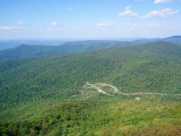
Mary's Rock, also known as Marys Rock, is a 3,514-foot (1,071 m) tall mountain in Shenandoah National Park, Virginia, United States. The peak is just south of the Thornton Gap Entrance of the park, and north of the taller Pinnacle. Mary's Rock is the eighth highest peak in Shenandoah National Park.
Contents
- Map of Marys Rock 2 East Luray VA 22835 USA
- Hiking Marys Rock
- Legends of Marys Rock
- Marys Rock Tunnel
- References
Map of Mary's Rock, 2, East Luray, VA 22835, USA
Hiking Mary's Rock
Two trails lead to the summit of Mary's Rock. One which starts from the Panorama Visitor Center and the other which starts from the Meadow Spring Parking Area. The trail from Panorama is somewhat longer and steeper, and is generally considered more difficult. It follows the white-blazed Appalachian Trail. The other trail is shorter and somewhat less difficult. The summit of the rock offers views of the northern section of Shenandoah National Park and Page Valley.
Legends of Mary's Rock
Mary's Rock has its fair share of legends of how the rock was named. One story claims that Francis Thornton wed Mary Savage and brought her up the mountain to show her the lands they would own together. Another legend claims that Thornton had a daughter named Mary, who climbed up the mountain when she was young and came back with a bear cub under her arm. Yet another states that it was named after the wife of William Randolph Barbee.
Marys Rock Tunnel
Marys Rock Tunnel is a 610-foot (190 m) long tunnel blasted through the mountain that Skyline Drive passes through. Constructed in 1932, it is considered one of the engineering feats of Skyline Drive.