
Country United States Reïncorporated 1851 Zip code 42064 Population 3,019 (2013) | Incorporated 1842 Elevation 181 m Local time Sunday 11:24 PM | |
 | ||
Weather 1°C, Wind NE at 10 km/h, 60% Humidity Area 8.676 km² (8.599 km² Land / 8 ha Water) | ||
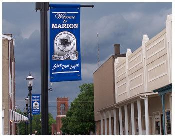
Discover marion kentucky
Marion is a home rule-class city in Crittenden County, Kentucky, in the United States. It is the seat of its county. As of the 2010 census, the city population was 3,039.
Contents
- Discover marion kentucky
- Map of Marion KY 42064 USA
- How to say or pronounce usa cities marion kentucky
- History
- Geography
- Demographics
- Arts and culture
- Education
- Notable people
- Climate
- References
Map of Marion, KY 42064, USA
The farm communities surrounding Marion are home to a large Amish population. The Marion-Crittenden County Airport is located west of the city.
How to say or pronounce usa cities marion kentucky
History
The city is named for Francis Marion, a brigadier general from South Carolina in the American Revolutionary War.
Marion was founded in 1842 on land donated by Dr. John S. Gilliam shortly after Crittenden County was created January 26, 1842, from a portion of Livingston County. The city was incorporated February 22, 1844, and a post office was established in 1846.
A railroad line from Blackford to Princeton was completed in 1887, and a depot was established at Marion. Originally owned by the Illinois Central Railroad, it has since been abandoned.
A one-room Rosenwald School opened in Marion in 1926 for African-American children. Graduates attended high school in neighboring Caldwell County until 1936, after which they attended high school in Princeton.
Geography
Marion is located near the center of Crittenden County at 37°19′57″N 88°4′45″W (37.332505, -88.079051). U.S. 60 and U.S. 641 intersect in the center of town. U.S. 60 leads northeast 30 miles (48 km) to Morganfield and southwest 45 miles (72 km) to Paducah, while U.S. 641 leads south 10 miles (16 km) to Fredonia and 20 miles (32 km) to U.S. 62 in Eddyville.
According to the United States Census Bureau, Marion has a total area of 3.4 square miles (8.7 km2), of which 0.03 square miles (0.07 km2), or 0.79%, is water.
Demographics
As of the census of 2000, there were 3,196 people, 1,415 households, and 881 families residing in the city. The population density was 971.7 people per square mile (375.1/km²). There were 1,595 housing units at an average density of 484.9 per square mile (187.2/km²). The racial makeup of the city was 96.65% White, 1.75% African American, 0.19% Native American, 0.03% Asian, 0.28% from other races, and 1.10% from two or more races. Hispanic or Latino of any race were 0.84% of the population.
There were 1,415 households, out of which 25.8% had children under the age of 18 living with them, 46.0% were married couples living together, 12.9% had a female householder with no husband present, and 37.7% were non-families. 35.5% of all households were made up of individuals and 19.6% had someone living alone who was 65 years of age or older. The average household size was 2.17 and the average family size was 2.79.
In the city, the population was spread out with 20.4% under the age of 18, 7.8% from 18 to 24, 24.8% from 25 to 44, 24.4% from 45 to 64, and 22.7% who were 65 years of age or older. The median age was 42 years. For every 100 females there were 81.2 males. For every 100 females age 18 and over, there were 77.9 males.
The median income for a household in the city was $23,854, and the median income for a family was $33,980. Males had a median income of $26,628 versus $18,646 for females. The per capita income for the city was $14,766. About 20.2% of families and 24.3% of the population were below the poverty line, including 36.5% of those under age 18 and 15.8% of those age 65 or over.
Arts and culture
The internationally known Ben E. Clement Mineral Museum is located in Marion. Its collection of fluorite crystal specimens is significant, and a reflection of Crittenden County's importance in the history of fluorite mining.
Marion was home to the Marion Bobcats, a wood bat baseball team in the Ohio Valley Summer Collegiate Baseball League, from 2008 to 2013.
The Holiday Drive-In Theater was located east of Marion, and had a 200-car capacity. It has since been demolished.
Education
Students are served by Crittenden County Schools.
Crittenden County Elementary School, Middle School and High School are each located in Marion.
Notable people
Climate
The climate in this area is characterized by hot, humid summers and generally mild to cool winters. According to the Köppen Climate Classification system, Marion has a humid subtropical climate, abbreviated "Cfa" on climate maps.