Coat of arms Flag Local time Monday 2:04 AM | Urban settlement Mariinsko-Posadskoye | |
 | ||
Weather -3°C, Wind SW at 21 km/h, 78% Humidity | ||
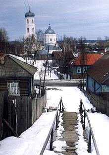
Mariinsky Posad (Russian: Марии́нский Поса́д; Chuvash: Сĕнтĕрвăрри, Sĕntĕrvărri) is a town and the administrative center of Mariinsko-Posadsky District of the Chuvash Republic, Russia, located on the right bank of the Volga River, 36 kilometers (22 mi) east of Cheboksary. Population: 9,088 (2010 Census); 10,273 (2002 Census); 10,443 (1989 Census).
Contents
- Map of Mariinsky Posad Chuvashia Republic Russia
- History
- Administrative and municipal status
- Economy
- Nature
- Education
- References
Map of Mariinsky Posad, Chuvashia Republic, Russia
History
It started as the village of Sundyr (Сундырь), which was founded in 1620 and named after the Sundyrka River (a tributary of the Volga). It was renamed Mariinsky Posad after Empress consort Maria Alexandrovna in 1856 and granted town status that same year.
Administrative and municipal status
Within the framework of administrative divisions, Mariinsky Posad serves as the administrative center of Mariinsko-Posadsky District. As an administrative division, it is incorporated within Mariinsko-Posadsky District as Mariinsko-Posadskoye Urban Settlement. As a municipal division, this administrative unit also has urban settlement status and is a part of Mariinsko-Posadsky Municipal District.
Economy
There are eleven processing, mechanical engineering, and construction materials factories in the town. Some of the other industries of employment in the city are a plant of cable works, a large automobile-repairing industry, a distillery, and a cooking oil-producing plant.
Nature
The area around the town has rich wildlife. There are several national parks and reservations nearby. The area is a popular ecotourism destination.
Education
The town has several schools.
