
Country East Timor Time zone UTC+9 Area 1,323 km² Capital Same, East Timor | Area rank 6th ISO 3166 code TL-MF Population 52,246 (2015) | |
 | ||
Subdistricts Alas, Fatuberlio, Same, Turiscai | ||
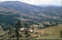
Same and manufahi district timor leste
Manufahi is one of the districts of East Timor. It has a population of 52,246 (2015 census) and an area of 1,323 km². The capital of the district is Same. The subdistricts are Alas, Fatuberlio, Same, and Turiscai.
Contents
- Same and manufahi district timor leste
- Map of Manufahi Timor Leste
- Small businesses development in manufahi district timor leste
- References
Map of Manufahi, Timor-Leste
During its time as a Portuguese colony, the district was called Same, after the capital city. It was the epicentre of the Great Rebellion of 1910–12. During the Indonesian occupation the subdistrict Hato-Udo was split off from the district and joined to Ainaro, and the subdistrict Turiscai, previously in Ainaro, was moved to Manufahi.
Manufahi lies on the south coast of East Timor, on the Timor Sea. It borders Manatuto District to the east, Ainaro District to the west, and Aileu District to the north.
Besides the national official languages of Tetum and Portuguese, the Malayo-Polynesian language Mambai is also spoken.