
- elevation 1,100 m (3,609 ft) - elevation 0 m (0 ft) | Basin area 17,175 km² | |
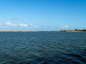 | ||
The Mangoro River is the largest river on the east coast of Madagascar by basin size and water volume, and is 300 km in length.
Contents
Map of Mangoro, Madagascar
Overview
The Mangoro begins northeast of the town of Anjozorobe in the Analamanga region, at approximately 1,100 meters. Its primary tributaries are the Onive River (which joins on the right bank at 200km from the river source) and Nosivolo River. Its mouth is at the Indian Ocean near the town of Ambodiharina.
Owing to its many tributaries, the Mangoro maintains a high flow year round, making it an ideal river for rafting.
As of 2012, the Sherritt International Corporation planned to use the Mangoro River as a source of water for a slurry pipeline carrying ore for the Ambatovy project mines, raising environmental concerns.
There is a road and rail bridge over the river west of Moramanga on Route nationale 2.
Wildlife
There are small populations of crocodiles in the more placid sections of the river. But their population is minimal and continues to plummet.