
Elevation 106 m | ||
 | ||
Volcanic arc/belt Auckland volcanic field Similar Maungarei, Mount Richmond, Mount Wellington - New Zeal, Maungawhau, Matukutureia | ||
Mangere mountain walk the present discover the past
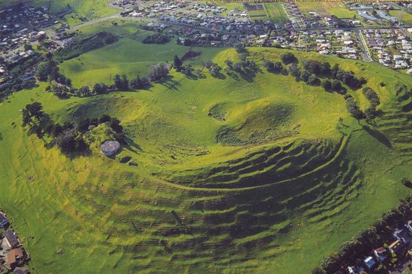
Mangere Mountain in Mangere Domain is one of the largest volcanic cones in the Auckland volcanic field, with a peak 106 metres above sea level. It was the site of a major pā (Māori fortified settlement) and many of the pā's earthworks are still obvious. It offers spectacular panoramic views of Auckland from its location in the suburb of Mangere.
Contents
- Mangere mountain walk the present discover the past
- Map of Mount Mangere Mangere Bridge Auckland 2022 New Zealand
- My gym mangere mountain
- References
Map of Mount Mangere, Mangere Bridge, Auckland 2022, New Zealand
The volcano features two large craters. It has a wide crater with a lava dome near its centre, a feature shared by no other volcano in Auckland. It last erupted approximately 18,000 years ago.
The mountain is one of the largest and best preserved of Auckland's volcanic cones. Many archaeological features remain, including kumara pits, garden terraces, walled garden mounds and stone boundary walls.
Near the mountain to the southwest is Mangere Lagoon, filling another volcanic crater.