
Time zone IST (UTC+5:30) Lok Sabha constituency Kothhagudem Elevation 267 m | Vehicle registration TS | |
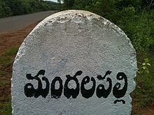 | ||
Mandalapalli (Telugu: మ౦దలపలి) is a Village in Dammapeta mandal in Khammam district, Telangana.
Contents
Map of Mandalapalli, Telangana 507306
Geography
Mandalapalli has an average elevation of 206 metres (679 ft). Located on the highway connecting Khammam and Rajahmundry between Sathupalli and Aswaraopeta.
The village has green fields, plantations, forest, hills, hillocks, ponds, lakes, and cattle.
Economy
Most the people are in agriculture. Paddy, maize, sugarcane, and groundnut are the main crops. Mango, cashew nut, palm oil and coconut are major plantation crops. All these crops are irrigated either from ground water or lakes.
There are many nurseries providing mainly mango plants.
As Mandalapalli is located on the highway, some people run small business like hotels and dhabas.
Places of worship
Schools
References
Mandalapalli Wikipedia(Text) CC BY-SA