
Administrative district Mamadyshsky District Local time Sunday 5:11 PM | Administrative center of Mamadyshsky District | |
 | ||
Municipal district Mamadyshsky Municipal District Urban settlement Mamadysh Urban Settlement Weather -1°C, Wind SE at 18 km/h, 69% Humidity Points of interest Kraevedcheskiy Muzey | ||
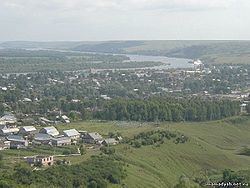
Mamadysh (Russian: Мамады́ш; Tatar: Мамадыш, Mamadış) is a town and the administrative center of Mamadyshsky District in the Republic of Tatarstan, Russia, located on the Vyatka River (Kama's tributary), 167 kilometers (104 mi) from the republic's capital of Kazan. As of the 2010 Census, its population was 14,435.
Contents
- Map of Mamadysh Republic of Tatarstan Russia
- History
- Administrative and municipal status
- Economy
- Demographics
- References
Map of Mamadysh, Republic of Tatarstan, Russia
History
Known since the end of the 14th–the beginning of the 15th century, it has been known as the selo of Troitskoye (Троицкое) from the beginning of the 17th century. Town status was granted to it in 1781. It served as the administrative center of a kanton in 1920–1930 and as the administrative center of a district since 1930.
Administrative and municipal status
Within the framework of administrative divisions, Mamadysh serves as the administrative center of Mamadyshsky District, to which it is directly subordinated. As a municipal division, the town of Mamadysh is incorporated within Mamadyshsky Municipal District as Mamadysh Urban Settlement.
Economy
As of 1997, industrial enterprises in the town included a wood-processing factory, a forestry farm, a cotton mill, a brick factory, a butter factory, and a distillery. The nearest railway station is Kukmor on the Kazan–Agryz line, located 80 kilometers (50 mi) southeast.
Demographics
As of 1989, the population was ethnically mostly Tatar (59.0%) and Russian (39.4%).