
Country United States Time zone Eastern (EST) (UTC-5) Elevation 99 m Population 13,005 (2000) Area code 518 | State New York Created 1802 FIPS code 36-44743 Zip code 12020 Local time Sunday 7:36 AM | |
 | ||
Weather -1°C, Wind N at 8 km/h, 62% Humidity Area 81.33 km² (72.52 km² Land / 8.806 km² Water) | ||
Malta new york luther forest community presented by coldwell banker prime properties
Malta is a town in Saratoga County, New York, United States. The town is in the central part of the county and is south of Saratoga Springs. The population was 13,005 as of the 2000 census.
Contents
- Malta new york luther forest community presented by coldwell banker prime properties
- Map of Malta NY 12020 USA
- History
- Geography
- Demographics
- Communities and locations in Malta
- Economy
- Transportation
- Educational institutions
- Notable residents
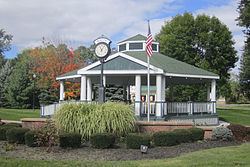
- Points of interest
- References
Map of Malta, NY 12020, USA
History
Tradition says a certain Drummond and McKelpin, Loyalists, were very early settlers, but left as the Revolutionary War came closer to the area. The earliest documented settlement occurred around 1771, with many of the settlers migrating from Connecticut. According to various sources, Michael Dunning may have been the first, while others included John Rhodes, Jeheil Parks, Samuel Clark, Luther Landon, Dean Chase, Ebenezer Valentine, Ebenezer Dibble, Ebenezer Millard, Obadiah Tompkins, Reuben Doolittle, Cornelius Abeel, Stephen Ireland, Robert Hemple, and William Marvin.
The town, originally called Dunning Street, was formed in 1802 from part of the Town of Stillwater. More territory was gained from the Town of Saratoga in 1805. The name "Malta" is said to derive from a malt brewery in the area that was formerly called "Malt-ville" and is now Maltaville.
The village of Round Lake was founded in 1868 as "the Round Lake Camp Meeting of the Methodist Episcopical Church." Attendance the first year was 8000. In 1869 permanent cottages began to be built, replacing the original tents. In 1969, the community of Round Lake became an incorporated village within the town.
The Dunning Street Cemetery, Ruhle Road Lenticular Metal Truss Bridge, and Wiggins-Collamer House are listed on the National Register of Historic Places.
Geography
According to the United States Census Bureau, the town has a total area of 31.4 square miles (81 km2), of which, 28.0 square miles (73 km2) of it is land and 3.4 square miles (8.8 km2) of it (10.71%) is water.
Part of the east town line is marked by Saratoga Lake. The Kayaderosseras Creek marks the north town line.
Exits 11, 12, and 13 of Interstate 87 ("The Adirondack Northway," or simply "The Northway") and US Route 9 pass through roughly the center of the town. New York State Route 9P is a short highway in the eastern part of the town. New York State Route 67 is a highway, partly conjoined with US-9, in the southern part of Malta.
Demographics
As of the census of 2000, there were 13,005 people, 5,295 households, and 3,537 families residing in the town. The population density was 464.2 people per square mile (179.2/km²). There were 5,754 housing units at an average density of 205.4 per square mile (79.3/km²). The racial makeup of the town was 96.24% White, 1.08% African American, 0.28% Native American, 1.05% Asian, 0.02% Pacific Islander, 0.52% from other races, and 0.82% from two or more races. Hispanic or Latino of any race were 1.45% of the population.
There were 5,295 households out of which 34.4% had children under the age of 18 living with them, 55.6% were married couples living together, 7.9% had a female householder with no husband present, and 33.2% were non-families. 24.6% of all households were made up of individuals and 6.0% had someone living alone who was 65 years of age or older. The average household size was 2.45 and the average family size was 2.96.
In the town, the population was spread out with 25.6% under the age of 18, 6.4% from 18 to 24, 36.6% from 25 to 44, 22.9% from 45 to 64, and 8.6% who were 65 years of age or older. The median age was 36 years. For every 100 females there were 100.4 males. For every 100 females age 18 and over, there were 99.7 males.
The median income for a household in the town was $57,037, and the median income for a family was $68,239. Males had a median income of $41,509 versus $31,126 for females. The per capita income for the town was $25,972. About 0.8% of families and 2.4% of the population were below the poverty line, including 1.5% of those under age 18 and 5.2% of those age 65 or over.
Communities and locations in Malta
Economy
Transportation
Malta is the center of an excellent road network; most transportation is by private car. The Capital District Transportation Authority (CDTA) operates scheduled buses through downtown Malta between Clifton Park and Saratoga Springs with connections to other lines. Commuter bus service to Albany is provided by the CDTA's "Northway Express" and Upstate Tours between Round Lake and Albany. Air service is provided from Saratoga County Airport (general aviation 5B2), 8 miles (13 km), and Albany International Airport(ALB), 20 miles (32 km). Amtrak provides train service from Saratoga Springs, 9 miles (14 km) or Albany/Rensselaer, 28 miles (45 km).
Educational institutions
Most of the Town of Malta is part of the Ballston Spa Central School District. Portions of the towns are served by the Shenendehowa Central School District and Saratoga Springs City School District.
Other educational institutions in Malta include:
Notable residents
Residents of Malta are known as "Maltese".