
Car plates GMB | Area 494.6 km² | |
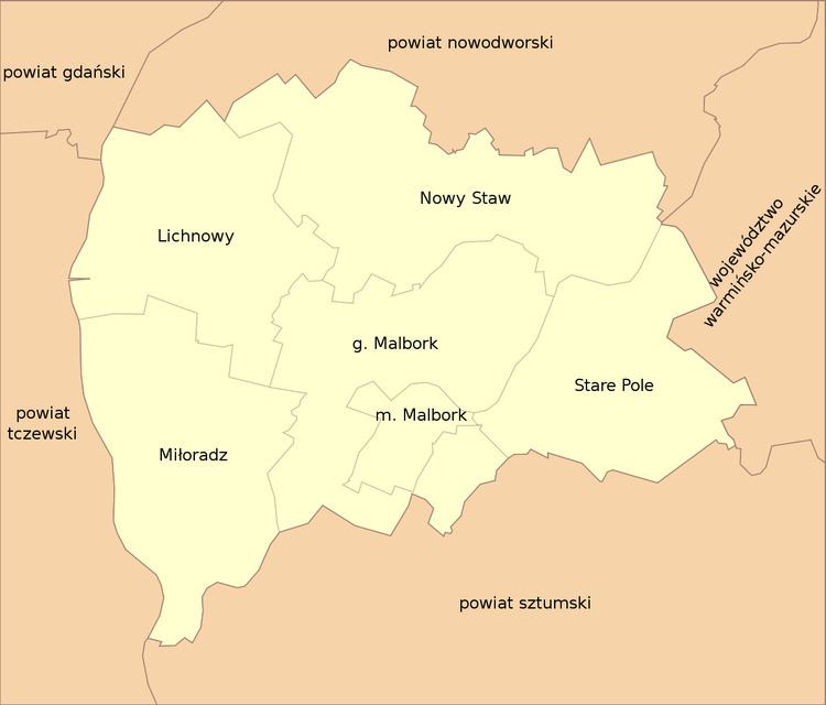 | ||
Gminas Total 6 (incl. 1 urban)MalborkGmina LichnowyGmina MalborkGmina MiłoradzGmina Nowy StawGmina Stare Pole Points of interest Malbork Castle, Park Dinozaurów ‑ Dino Pa, Muzeum Zamkowe w Malborku, Nogat, Park Miejski | ||
Malbork County (Polish: powiat malborski) is a unit of territorial administration and local government (powiat) in Pomeranian Voivodeship, northern Poland. It came into being on January 1, 1999, as a result of the Polish local government reforms passed in 1998. Its administrative seat and largest town is Malbork (site of the historic Malbork Castle), 46 kilometres (29 mi) south-east of the regional capital Gdańsk. The only other town in the county is Nowy Staw, lying 12 km (7 mi) north of Malbork. Until 2002 the county also included the areas which now make up Sztum County.
Contents
Map of Malbork County, Poland
The county covers an area of 494.63 square kilometres (191.0 sq mi). As of 2006 its total population is 62,960, out of which the population of Malbork is 38,478, of the urban-rural gmina of Nowy Staw is 4,447, and of the rural gminas is 20,035.
Malbork County on a map of the counties of Pomeranian Voivodeship
Malbork County is bordered by Nowy Dwór Gdański County to the north, Elbląg County to the east, Sztum County to the south, Tczew County to the west and Gdańsk County to the north-west.
Administrative division
The county is subdivided into six gminas (one urban, one urban-rural and four rural):