Main Street is a street in Hamilton, Ontario, Canada.
Main Street was originally called Court Street, after the first courthouse that stood on it. It is now called Main Street because it formed the "main" concession line of Barton Township.
On June 20, 1877, the first commercial telephone service in Canada began in Hamilton, Ontario. Hugh Cossart Baker, Jr. learned of Alexander Graham Bell's invention in 1877 at the Philadelphia International Exposition and from there decided to test the communication tool in Hamilton. Hugh Cossart Baker Jr. is credited with making the first telephone exchange in the British Empire from an office building (Exchange Building) at the corner of James and Main Street East which still stands there today (March 2007).
In 1925, The first traffic lights in Canada went into operation at the Delta. (11 June 1925).
McMaster University arrived in Hamilton in 1930 from Bloor Street in Toronto. The total student population at McMaster University is well over 27,000. Almost two-thirds of the students come from outside the immediate Hamilton region.
Built in 1931, Westdale Secondary School was immediately deemed the largest composite school in the British Empire, having cost $1.3 million to build and consisting of 4.7 hectares of building, grounds and athletic fields.
Landmarks
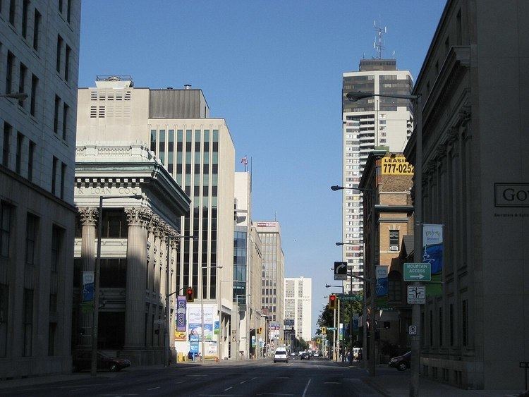
Crystal Palace SiteWentworth County Court House SiteNote: Listing of Landmarks from West to East.
White Chapel CemeteryCNIB buildingCanadian Martyrs Elementary SchoolMcMaster UniversityScottish Rite Castle/ Masonic Centre, Originally the home of George Elias Tuckett, (1835-1900), Tuckett Tobacco Company owner + Hamilton's 27th Mayor in 1896. (just South of Main Street on Queen Street SouthHess VillageBay 200, residential apartment building (Hamilton's 10th-tallest building, just South of Main Street West)Hamilton-Wentworth District School Board BuildingNew Hamilton City HallIrving Zucker Sculpture CourtMacNab Street Presbyterian ChurchHamilton Street RailwayHamilton Public LibraryCanadian Football Hall of Fame MuseumBank of Montreal Building (Hamilton) (converted to a National Law firm office)Landed Banking and Loan Company buildingExchange Building (site of the first telephone exchange in the British Empire)John Sopinka CourthouseHamilton CourthouseLandmark Place (Hamilton's tallest building)First Place HamiltonDon Cherry's Grapevine siteSt. Patrick ChurchSt. Patrick Elementary SchoolCathedral Secondary SchoolColumbia Elementary SchoolGage ParkHamilton Children's Museum (inside Gage Park)Gage Park Bandshell (concert stage)Gage Park fountainMemorial Elementary SchoolOttawa Street Shopping District - "Textile District"Delta Secondary SchoolMontgomery ParkBurlington Synchronized Swimming ClubQueenston Traffic Circle (Queenston Road branches off from this point)Sir Winston Churchill ParkSir Winston Churchill Secondary SchoolParkdale ParkParkdale ArenaRoxborough ParkNote: Listing of neighbourhoods from West to East.
Ainslie WoodWestdaleStrathcona/ Kirkendall NorthCentral/ DurandBeasley/ CorktownLandsdale/ StinsonGibson/ St. ClairStipley/ BlakeleyCrown Point West/ Delta WestCrown Point East/ Delta EastHomeside/ BartonvilleNormanhurstMcQuesten WestLower City Roads:
Burlington Street, West/EastBarton Street, West/EastCannon Street, West/EastWilson StreetKing William StreetKing Street, West/EastMain Street, West/East; - Queenston RoadJackson Street, West/EastHunter Street, West/EastAugusta StreetCharlton Avenue, West/EastAberdeen AvenueNiagara Escarpment (Mountain) Roads:
Concession StreetQueensdale Avenue West/ EastScenic Drive - Fennell Avenue, West/EastSanatorium RoadMohawk Road, West/EastLimeridge Road West/EastLincoln M. Alexander Parkway - Mud Street, (Hamilton City Road 11)Stone Church Road, West/East; Rymal Road, West/EastTwenty RoadNote: Listing of streets from West to East.
Cootes DriveLongwood Road, South Chedoke Parkway, (passes underneath King Street West bridge)Dundurn Street, SouthLocke Street, SouthQueen Street, SouthHess Street, SouthBay Street, SouthMacNab Street, SouthJames Street, SouthHughson Street, SouthJohn Street, SouthCatharine Street, SouthFerguson Avenue, SouthWellington Street, SouthVictoria Avenue, SouthWentworth Street, SouthSherman Avenue, SouthGage Avenue, SouthOttawa Street, North, SouthKenilworth Avenue, North, SouthParkdale Avenue, North, South