
 | ||
Mahuli fort trek asangaon maharashtra
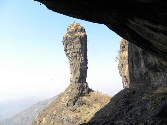
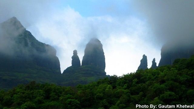
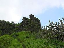
Mahuli Fort at 2815 ft, this is a popular trekking destination and a paradise for rock-climbers because of many nearby pinnacles with interesting names like Vazir, Vishnu, etc., given by the local trekking and climbing fraternity. This mountain complex is actually a group of two or more hills with common cols and pinnacles.
Contents
- Mahuli fort trek asangaon maharashtra
- Marathi vlog 21 solo trek to mahuli fort part 1
- Reaching there
- History
- Facilities and Eco Development
- References

It is the highest point in the Thane district. The forest surrounding Mahuli has been declared as a sanctuary. Once Shahaji Raje, father of Chatrapati Shivaji Maharaj, had this fortress. The fort has been declared as a protected monument.
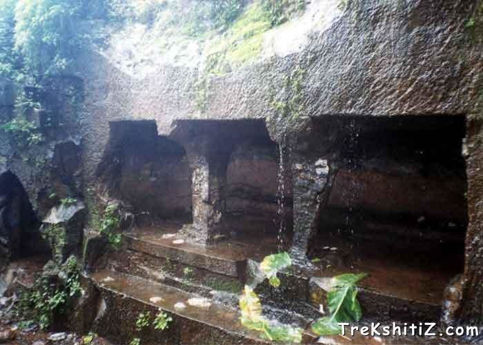
Besides an open Shiva temple there is a small perennial drinking water cistern on top, three caves of which the larger can be used as overnight shelter, like as on many other such natural hill forts of Maharashtra Western Ghats (Sahyadri Range). There is a stone arch historically known as the 'Kalyan Darwaja' but the dome of the arch is now broken.
Marathi vlog 21 solo trek to mahuli fort part 1
Reaching there
Asangaon on Mumbai-Nashik highway (91) km from Mumbai. 5 km inside on to the left is the Mahuli village. The nearest railway station to Mahuli is Asangaon. One can catch either Asangaon or Kasara Local from Mumbai CST, which could also be caught at Kalyan or Thane Junction.
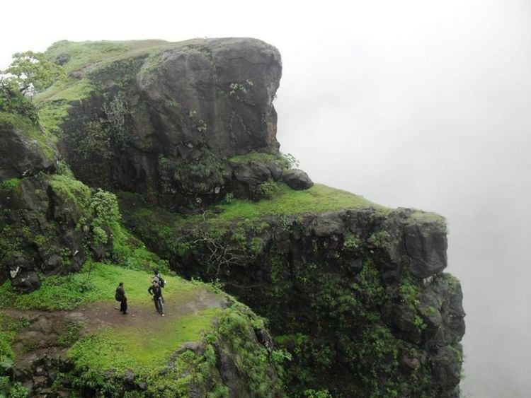
If coming by train, alight at Asangaon railway station, cross the national highway (commonly known as 'Agra Road'), walk about 1 km towards Shahpur on the highway. Turn left on the road going to Manas Mandir (a religious place for the Jain community), walk further 15–20 minutes, don't turn right for Manas Mandir but keep walking straight ahead past a government forest check post, towards Mahuli Village. Walk through the village and about five minutes later reach the Shiva temple right at the base of the fort. One can drive right up to this temple, though the road at many places is quite bad and narrow. There is a well with perennial drinking water in the temple compound. Locally made tea, snacks, lunch made by villagers may be available on weekends. Night halt can be made at this spacious and clean temple with the pujari's (temple priest) consent. 4 km brisk walk from Asangaon station will take you to the base temple in an hour. After the temple there are no human settlements towards the fort. Recently the Maharashtra Government has started to develop it as a tourist spot. They are now helping tourist and trekkers with basic direction. Government has now started to collect ₨ 20 per person for maintenance. Cross a seasonal stream, quite fast after an especially heavy downpour. Now the ascend begins along a prominent trail. A 3-hour trek with a prominent route will take you to the top-most plateau on the fort, which is actually a complex of three mountains and many pinnacles. There is a difficult-to-climb rock patch just below the plateau but in recent years an iron ladder has been placed to overcome this tricky part of the climb. You can board Auto from Asangaon Station to Mahuli Fort, pay them as per the Rate card placed on the Board at the stand
To get a close-up view of the many curiously shaped pinnacles from behind the fort, alight at Vasind Railway Station, go about 5 to 7 km on a narrow road keeping the mountain to your right. Go behind the fort, preferably with a local villager’s help, reach a remote place in the forest locally called ‘Ambyache Paani’ (water at the mango tree). Water here is present throughout the year; one may have to dig the soil to reach water in the earth in the summer months from end-March to mid-June. For those venturing among the pinnacles, be wary of the numerous beehives hanging from overhangs on the vertical cliffs.
History
The creator of this fort are Mughals. In 1485 this place came under rule Nijamshahi dynasty. When Shahaji Raje became the secretary of Nijamshahi, Mughals of Delhi tried to end Nijamshahi. In 1635-36, Shahaji Raje transferred himself with Jijabai and Shivaji to Mahuli. When Khan Jaman attacked the fort, Shahaji asked Portuguese for help, who refused and Shahaji surrendered.
Shivaji took this fort from Mughals on 8 Jan 1658. In 1661 it was given back and was won again by Shivaji. In treaty of Purandar, in 1665, Marathas lost these forts again. In Feb 1670, Shivaji Maharaj tried to conquer Mahuli, but failed, Manohardas Gaud, was the in charge of the fort. A thousand Marathas were killed.Most of them were from nearby villages.Shivaji Maharaj said to his dead kadam sardar he is our gold. So maharaj gave the Sonare surname to this family. Manohardas Gaud, soon gave up his position and Alveerdi Beg took over. On 16 June 1670, after two months, Moropant Pingle conquered the forts and Mahuli, Bhandargad and Palasgad became part of Swarajya. Till 1817, Shivaji's dynasty owned the fort but later on it was controlled by the British Raj.
Facilities and Eco Development
The fort comes under jurisdiction of Tansa Wildlife Sanctuary. To enhance responsible ecotourism, recently 'Mahuli Gad Eco Development Committee' is formed under joint forest management regimes. This shall ensure ecosystem as well as livelihood issues of local people. the fort is also proposed to be restored through consulting ASI. The details available in website thanewildlife.org
1) Nature camping facility available at Base station
2) Women's Saving Group (Mahila Bachat Gath) is also providing meals/mineral water on request.