
Elevation 750 m | ||
 | ||
Topo map USGS Old Speck Mountain Traversed by Appalachian National Scenic Trail Similar Appalachian National Scenic Tr, Goose Eye Mountain, Baldpate Mountain, Grafton Notch, Mount Success | ||
Mahoosuc Notch is a deep gap in the Mahoosuc Range of western Maine in the United States. It is traversed by the Appalachian Trail.
Contents
Map of Mahoosuc Notch, North Oxford, ME 04261, USA
Description
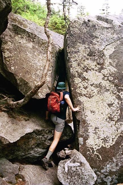
The boulders on this mile-long section of trail present obstacles that must be climbed over and sometimes under, creating a unique hiking experience. There are occasional 10-foot (3.0 m) drops, and places where packs must be removed to squeeze beneath a boulder.
Many hikers call this stretch one of the slowest on the 2,179-mile (3,507 km) trail. This so-called "killer mile" or the "Toughest Mile" is a very tough section that can cause even the most experienced hikers to slow down.
References
Mahoosuc Notch Wikipedia(Text) CC BY-SA