
Elevation 860 m | ||
 | ||
Municipalities BurauenLa PazMacArthur Similar Cancajanag, Latukan, Mount Amorong, Mount Balatukan, Mount Makaturing | ||
Mahagnao Volcano also known as part of (Mahagnao Volcano Natural Park) is a dormant volcano located in the Barangay Mahagnao part of the municipality of Burauen province of Leyte, Philippines. It is also bounded by the municipalities of La Paz and MacArthur. The area is mostly composed of wetland forests and also the birth of many rivers and streams flowing on many part of Burauen and on its neighboring towns.
Contents
- Map of Mahagnao Volcano La Paz Leyte Philippines
- Physical Features
- Eruptions
- Listings
- Mahagnao Volcano Natural Park
- References
Map of Mahagnao Volcano, La Paz, Leyte, Philippines
Because of the abundance of fresh waters on its area, Burauen was also known as the Spring Capital of Leyte.
Physical Features
The summit of the volcano is a steep-walled heavily forested crater that opens to the south with a peak elevation of 860 metres (2,820 ft). Located on the volcano flanks are fumaroles and mudpots.
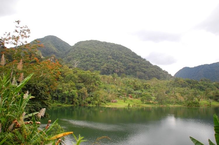
On the southern flank of the volcano, two crater lakes are located, Lakes Danao and Malagsom. Hot Springs are located on the southern shore of Lake Danao (not to be confused with the other Lake Danao which is located near Ormoc City and part of Lake Danao Natural Park). Lake Malagsom is a crater lake with green acidic water.
Rocks primarily found on the volcano are andesite.
Eruptions
An eruption was reported to have occurred in 1895 but no further details are available.
Listings
Philippine Institute of Volcanology and Seismology (PHIVOLCS) classifies Mahagnao as inactive volcano even with the active thermal features of the mountain.
Mahagnao Volcano Natural Park
Mahagnao Volcano is the focal point of the Mahagnao Volcano National Park created on August 27, 1937 with Proclamation No. 184 with an area encompassing 635 hectares (1,570 acres). Under the National Integrated Protected Areas System (NIPAS) of the Department of Environment and Natural Resources, the park was renamed to Mahagnao Volcano Natural Park with Proclamation No. 1157 on February 3, 1998.