
Established 1915 Elevation 63 m Postal code 5311 | Postcode(s) 5311 Founded 1915 | |
 | ||
LGA(s) District Council of Loxton Waikerie | ||
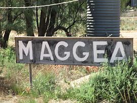
Maggea is a locality and former settlement in the Murray Mallee region of South Australia. It is on the Stott Highway between Swan Reach and Loxton and was on the former Waikerie railway line. The town is almost deserted now that the railway line has closed.
Map of Maggea SA 5311, Australia
Maggea was named in 1915 after the local Aboriginal Australian name for camp. The school operated in the hall from 1919 to 1967.
References
Maggea, South Australia Wikipedia(Text) CC BY-SA