
Country Language spoken | State District Tumkur | |
Madhugiri is a Taluk headquarters in Tumkur district in the Indian state of Karnataka. The town derives its name from a hillock, Madhu-giri (honey-hill) which is to the north of the place.
Contents
- Map of Madhugiri
- Worlds second largest single monolitic stone hill madhugiri hill
- Trek to honey hills madhugiri hills asias second largest monolith hill
- Attractions
- Geography
- Agriculture
- References
Map of Madhugiri
Madhugiri has been declared as Educational District by karnataka state educational department. It includes Madhugiri, Sira, Koratagere and Pavagada Taluks.
Worlds second largest single monolitic stone hill madhugiri hill
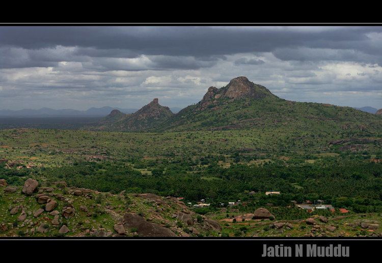
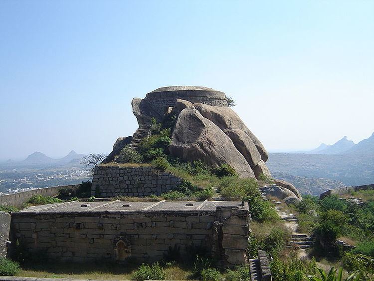
At 3,930 ft (1,200 m) elevation, Madhugiri is a single hill. It is the second largest monolith in Asia.[1] Nestled on its steep slopes is a fort. Antaralada Bagilu, Diddibagilu, and Mysore Gate are the three gateways of the fort. A series of doorways leads to the hill. The ruined temple of Gopalakrishna is located at the top.
Trek to honey hills madhugiri hills asias second largest monolith hill
Madhugiri, or also known as Maddagiri, is located around 43 km north of Tumkur town, and 107 km north-west of Bangalore city. The monolith and the surrounding greenery of Madhugiri are the main attractions. The place has old temples of Venkataramanaswami and Malleshwara built by the Vijayanagara feudatories in the Dravidian style.
The highlight is the rock dome, atop which stands a fort. There are a series of doorways leading to the top and the climb is steep and exposed in some places. On the top is the ruined Gopalakrishna temple.
Attractions
Geography
Madhugiri is located at 13.66°N 77.21°E? / 13.66; 77.21. It has an average elevation of 787 metres (2582 feet).
Agriculture
The prime crops that are grown in Madhugiri are groundnut, ragi and mango, sericulture, coconut and Kakada (flower). It is known for pomegranate fruit (daalimbe in Kannada).