
 | ||
Mackinac Trail, or Mackinaw Trail is the name for two related, but separate, roadways in the US state of Michigan.
Contents
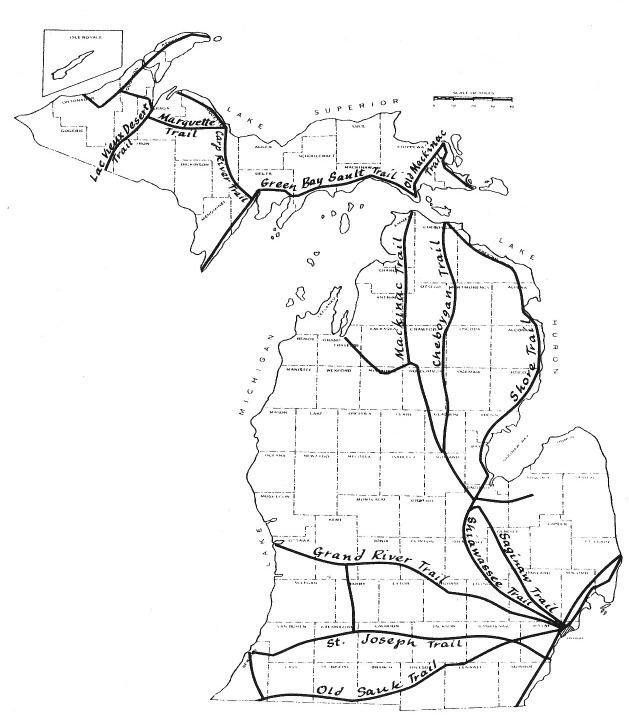
The trail is a historically important land route between the Straits of Mackinac and the rest of Michigan, both from the north and the south. The trail was first used by the tribes of Michigan, and surveyed between Saginaw and Mackinac in 1835, by Lieutenant Benjamin Poole of the 3rd U.S. Artillery. The trail continues across the strait in the Upper Peninsula between St. Ignace and Sault Ste. Marie.
The name has also been used for roads in the northwestern Lower Peninsula.
Upper Peninsula
Lower Peninsula
In Saginaw, Mackinaw Street closely follows Poole's route in the general direction of present-day Midland until the western city limits, where Mackinaw Street twists north, becoming Mackinaw Road and following a section line into Bay County. Poole's route between Midland and Mackinac follows the Tittabawassee River north, crosses the Au Sable and Thunder Bay rivers, and reaches Lake Huron near present-day Cheboygan.
Roads in the northwest Lower Peninsula that have been associated with the Mackinaw Trail: