
OS grid reference NR891345 Post town ISLE OF ARRAN Local time Friday 4:46 AM | Sovereign state United Kingdom Postcode district KA27 Dialling code 01770 Civil parish Kilmory, Arran | |
 | ||
Weather 6°C, Wind W at 40 km/h, 88% Humidity | ||
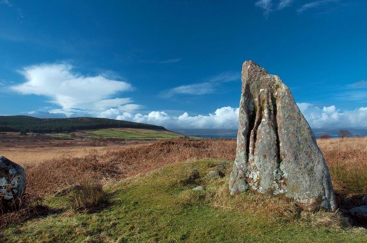
Machrie moor prehistoric site isle of arran scotland
Machrie (Scottish Gaelic: Am Machaire) is a village on the Isle of Arran in the Firth of Clyde, Scotland. Machrie Bay can be found on the West Coast. The village is within the parish of Kilmory.
Contents
- Machrie moor prehistoric site isle of arran scotland
- Map of Machrie Isle of Arran UK
- Stone circles machrie moor isle of arran scotland
- Machrie Moor
- References
Map of Machrie, Isle of Arran, UK
It is most well known for its Standing Stones that are a local tourist attraction, along with the King's Cave which was believed to have been used by Robert the Bruce.
Stone circles machrie moor isle of arran scotland
Machrie Moor
Machrie Moor is the site of a number of neolithic structures dating back up to 4500 years ago. These include the six Machrie Moor Stone Circles, and Moss Farm Road Stone Circle. The standing stones were dated back to approximately 2500 years ago but excavations in the 1980s uncovered elaborate timber structures and stone circles which dated back even further in history.
References
Machrie Wikipedia(Text) CC BY-SA