
Phone +852 3105 0767 | ||
 | ||
Hours Open today · Open 24 hoursFridayOpen 24 hoursSaturdayOpen 24 hoursSundayOpen 24 hoursMondayOpen 24 hoursTuesdayOpen 24 hoursWednesdayOpen 24 hoursThursdayOpen 24 hours Similar | ||
Hong kong hiking maclehose trail stages 1 2 1 2
The MacLehose Trail (Chinese: 麥理浩徑), opened on 26 October 1979, is a hiking trail that crosses much of the New Territories, starting from Pak Tam Chung, Sai Kung, in the east to Tuen Mun in the west in the territory of Hong Kong. The whole trail is 100 kilometres long, marked by distance posts at 500m intervals along the path. It is named after Sir Murray MacLehose, the longest serving governor of Hong Kong, who established the Country Parks and was himself an enthusiastic hiker. The trail passes through a variety of natural scenery including beaches and mountains.
Contents
- Hong kong hiking maclehose trail stages 1 2 1 2
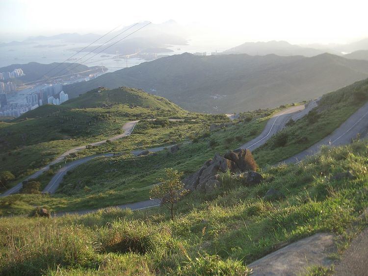
- Hiking maclehose trail stage 4 hong kong
- Stages
- Trailwalker
- References
The New Territories, through which the MacLehose Trail runs, covers the majority of the SAR's land area. The east coast, where the Trail begins, is deeply indented and wild. The central mountains, which the MacLehose Trail crosses, include many of Hong Kong's highest peaks. The western part, where the trail winds to its end features numerous valley reservoirs.
Hiking maclehose trail stage 4 hong kong
Stages
The MacLehose Trail is divided into ten stages:
Easy Walk
Fairly Difficult
Very Difficult
Stage one starts flat and gradual on the south side of High Island Reservoir, in Sai Kung East Country Park (4,477 hectares). This is a pleasant beginning. It passes through paths over viewing damn and reservoirs like the Tai Tum Tuik Reservoir. Mini bus or bus are available as public transportation.
Stage two is located on the rolling hills of the East Sai Kung Peninsula. 'The route begins at Long Ke, then makes a steep ascent to Sai Wan Shan. Climbing up here, one has majestic views over a superb coastline - and north towards conical Sharp Peak. After dropping down to Sai Wan, the Trail follows the beaches to Ham Tin, then turns inland over the coastal hills. Finally section Two skirts some shallow sea inlets, before ending at Pak Tam Au.'
'The rocks near Long Ke are rhyolite, a fine grained volcanic rock formed when lava cools rapidly. Rhyolite's six-sided crystals create, on a much larger scale, hexagonal columns of rock -- which give the Long Ke coastline its distinct appearance. Jagged brown-grey columns of rhyolite rear up everywhere.'
Trailwalker
Oxfam Trailwalker, a major fundraising event which takes place annually in November on the MacLehose Trail and additional route. The Starting Point is at Pak Tam Chung in Sai Kung and the Finishing Point is at Po Leung Kuk Jockey Club Tai Tong Holiday Camp in Yuen Long.