
Type Motorway Constructed August 1992 | Length 38 km | |
 | ||
Opened August 1992 (M5 South-West)December 2001 (M5 East) Route number(s) M5 (2013–present)Entire route Formerroute number Metroad 5 (1993/2001-2013) East end General Holmes DriveKyeemagh, New South Wales | ||
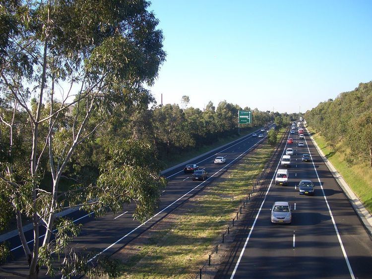
The M5 Motorway is a 30-kilometre-long (19 mi) motorway located in Sydney, New South Wales, Australia that is designated with the M5 route and forms part of the Sydney Orbital Network. The M5 route number comprises two separate parts, separately owned and operated.
Contents
- Map of S Western Motorway New South Wales Australia
- M5 South West Motorway
- M5 East Motorway
- New M5 WestConnex
- Metroad 5
- References
Map of S Western Motorway, New South Wales, Australia
The original section that opened in 1992 is titled M5 South-West Motorway and is a toll road operated by Interlink Roads. Its southwestern terminus is south of an interchange near Prestons where the M5 meets the Westlink M7 and the M31 Hume Motorway. The M5 South-West Motorway eastern terminus is located 20 kilometres (12 mi) to the east at an exit junction with King Georges Road at Beverly Hills.
The M5 continues east as the 10-kilometre-long (6.2 mi) and untolled NSW Government-owned M5 East Motorway that includes substantial tunnels, opened in 2001 to connect with General Holmes Drive (M1) at Kyeemagh.
A third section of the motorway, referred to as the New M5, is in the approval phase for a mid-2016 construction commencement. This segment, part of the WestConnex project will link to an upgraded King Georges Road interchange on the existing M5 East at Beverly Hills and continue along a separate 11 km (6.8 mi) route via twin tunnels to St Peters.
M5 South-West Motorway
The M5 South-West Motorway replaces the Hume Highway (Liverpool Rd) as the primary route from Liverpool to the Sydney CBD. In the 1980s the Hume Highway (National Highway 31) ended at Crossroads, just before Liverpool. This stretch of freeway (Campbelltown to Crossroads) was previously known as South Western Freeway designated F5.
From then on, to proceed to the city, the alternatives were either Liverpool Road (then National Route 31) or Newbridge Road (State Route 54) via Bankstown. Both routes have many traffic lights and are frequently heavily congested.
An initial stretch of the motorway was built in the mid-1980s to link Heathcote Road at Moorebank and the Hume Highway at Casula, including a bridge across the Georges River near Casula. Although built as dual carriageway at near freeway standard, this initial stage included a traffic light controlled, at-grade intersection at Moorebank Avenue.
After years of proposals and political promises, a privately constructed and operated motorway – the M5 South-West Motorway – was built under a "Build-Operate-Transfer" agreement. It was constructed on a publicly owned freeway reservation, between the existing road at Heathcote Road, Moorebank, to King Georges Road, Beverly Hills. Opened in August 1992, it was "completed" months ahead of schedule, even though the proposed link between the Cross Roads and Casula had yet to be constructed, and a third of the "motorway" existed only as single lane road between the Fairford Road interchange and the King Georges Road interchange, remarkably located at the busier city end of the road. Privately operated by Interlink Roads, the South-West Motorway is tolled at Hammondville, and will be transferred to the NSW Government in 2026. Regular users of the motorway can claim a rebate from the state government for the cost of the toll, excluding GST, as part of an 1995 election commitment by former Premier Bob Carr.
Metroad 5 was introduced in late 1992 along with other Metroads and was signed in February 1993. The South-West Motorway from Beverly Hills to Moorebank and Crossroads to Campbelltown, Hume Highway from Moorebank to Crossroads, were allocated Metroad 5. When the Casula bypass opened in 1994, the Hume Highway section of Metroad 5 was realigned to the bypass and the entire South-West Motorway therefore had the route allocation of Metroad 5.
As part of the construction of the M5 East, the eastern single laned section of the South-West Motorway was widened to a full 4 lanes, finally bringing most of the M5 up to complete freeway standard. However, the at-grade intersection at Moorebank Avenue still remained, posing a constraint on traffic flow. Finally in 2003, the state government opened a new, completely grade separated interchange at Moorebank Avenue, meaning that not only the entire length of Metroad 5 was now freeway standard but also the entire route from Canberra to Sydney, and Melbourne to Sydney, is now high-speed dual carriageway. It should be noted however, that traffic entering the South-West Motorway from Moorebank Avenue at its southern on-ramp still has to merge with traffic leaving the South-West Motorway intending to use the Hume Highway exit at Liverpool.
With the completion of the Westlink M7 motorway in December 2005, the Roden Cutler Interchange was added at Prestons to allow traffic from the south to access western Sydney or bypass the city altogether.
Between 2012 and 2014, the motorway was widened to three lanes in each direction.
M5 East Motorway
After the Casula bypass from the Cross Roads and Casula was completed, the motorway still abruptly ended at King Georges Road, meaning that motorway traffic was forced onto congested roads to complete the journey into the city. In response, a publicly built link, known as the M5 East Freeway (now referred to as "Motorway") was constructed between the existing motorway at King Georges Road and General Holmes Drive (Metroad 1) at Mascot, adjacent to Sydney Airport, and includes two stretches of tunnel, a 4 km long tunnel between Kingsgrove and Arncliffe, with another tunnel under the Cooks River. Construction was commenced in August 1998 and the M5 East was opened in December 2001. Metroad 5 from Beverly Hills to the CBD, originally via Hume and Great Western Highway, was rerouted on the M5 East Freeway and ended at its terminus at General Holmes Drive.
Controversy surrounded the construction of the M5 East concerning the effect of the freeway on the local environment, especially upon parts of Wolli Creek, and the construction of ventilation stacks required to remove pollution from the tunnel, which, ostensibly due to cost, lack filtration systems. Since its opening, the M5 East has attracted criticism for its lack of capacity, given that the tunnels provide only two lanes of traffic in either direction, and no provision has been made for future expansion. Most congestion problems occur at the western end of the main tunnel, which is long and steep.
An addition lane for slow traffic begins at the western tunnel exit for a short distance, to remove slow and heavy traffic. Had this been extended into the tunnel for a few hundred metres, the capacity would be far greater. These steep entrances to the tunnelled section are also the site of frequent vehicle accidents, usually involving heavy traffic. Pollution and smog inside the tunnel has also been a major concern, after it was revealed that the New South Wales Department of Health advised the New South Wales Roads and Traffic Authority that pollution levels in the tunnel exceeded acceptable limits during peak hours of use, and urged motorists using the tunnel to keep their windows up and putting their car's ventilation system on "recirculate".
The M5 East has been beset by many closures, due to accidents and computer failures within the tunnel, which cause gridlock. Between 2002 and 2008 there were six closures attributed to technical and computer failures alone in the tunnel. The Government of New South Wales must pay penalties to the operators of the M5 East, BHBB, due to more traffic using the M5 than originally forecast. The penalties were expected to amount to $13 million by 2011. Some of this increase in demand was caused by the State Government's "Cashback" scheme, which involves public money subsidising motorists for using the adjoining, tolled M5 South-West Motorway.
New M5 (WestConnex)
A new motorway referred to as the "New M5" forms stage two of the WestConnex project. This is planned as a new route that will branch off the existing M5 East at Beverley Hills and run through twin tunnels to a new interchange at St Peters near the airport. This road would ultimately connect with the M4 to M5 link planned for stage three of WestConnex to form a CBD bypass. Construction began of the new tunnels in mid-2016 with an expected completion date of early 2020.
Metroad 5
From its inception in 1992 until alphanumeric route numbers were introduced to New South Wales in 2013, the M5 motorway carried the Metroad 5 shield. However Metroad 5 and the M5 were not synonymous. The original Metroad 5 route commenced at the Hume Highway at Casula, before following the original extent of the M5 South-West Motorway, and then following King Georges Road, Hume Highway and Parramatta Road into the city. In 1994, the Metroad 5 route was moved onto the new Casula Bypass section of the M5, and 1998 it was extended significantly to the southwest to meet Metroad 9 near Campbelltown (replacing what was previously National Highway 31). Finally in 2001 with the opening of the M5 East Freeway, the Metroad 5 route was changed significantly to follow the new motorway to meet Metroad 1 near the airport instead of travelling to the city.
With the introduction of alphanumeric route numbers in 2013, most of the Metroad 5 route was transitioned to route M5. However the Campbelltown to Prestons section has reverted to the updated incarnation of its previous marker, as part of the M31 Hume Motorway.