
Population 5,707 (2006 census) | Postcode(s) 2210 Postal code 2210 | |
 | ||
Location 23 km (14 mi) south of Sydney CBD | ||
57 blackbutt avenue lugarno new south wales avi
Lugarno is a suburb in southern Sydney, in the state of New South Wales, Australia. Lugarno is located 23 kilometres south of the Sydney central business district in the local government area of the Georges River Council and is part of the St George area.
Contents
- 57 blackbutt avenue lugarno new south wales avi
- Map of Lugarno NSW 2210 Australia
- History
- Parks and waterways
- Churches
- Commercial area
- Public transport
- Sport and recreation
- Population
- Education
- References
Map of Lugarno NSW 2210, Australia
Situated on the northern bank of the Georges River, Lugarno is known for its large areas of bushland. Peakhurst and Peakhurst Heights, to the north, are the only adjacent suburbs. Nearby suburbs include Alfords Point, Illawong (on the other side of the Georges River), Padstow Heights (on the other side of Salt Pan Creek) and Oatley (on the other side of Lime Kiln Bay).
History
Lugarno was named after Lake Lugano, Switzerland by surveyors Major Sir Thomas Livingstone Mitchell (1792-1855) and William Govett (1807-1848) in 1843. An extra 'r' was added for the suburb name. Thomas Lawrence was granted 120 acres (0.49 km2) of land in 1831, on the western side of the peninsula near Salt Pan Creek. Land grants to the east and north were made in 1856 to T.G.Lee with 113 acres (0.46 km2), Frewin Sleath with 45 acres (180,000 m2), John Lushy with 41 acres (170,000 m2) and J.P. Henning with 40 acres (160,000 m2).
The whole area between Arncliffe and Lugarno was originally heavily timbered. Illawarra Road was built by convicts in 1841 and it ran through Gannon’s Forest, down to the Georges River. The road from Arncliffe was later known as Gannon's Forest Road and today is known as Forest Road. The name has been retained in Old Illawarra Road, over the river in Menai and Lucas Heights.
A punt operated from Lugarno across the river from 1843. An established ferry serviced the area from 1887 to 1974, closing with the opening of the Alfords Point Bridge. The suburb was developed into mainly residential in the 1960s when land was released for home sites.
Lugarno suffered critical fire outbreaks during the Ash Wednesday bushfires of 1983, the 1996 bushfires and the Christmas 2001/Summer 2002 bushfires.
Parks and waterways
Churches
St Stephens Anglican Church, Lugarno-Peakhurst Uniting Church and Church of Samoa Parish of Sydney.
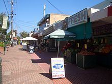
Commercial area
Lugarno has two small sets of shops. At Chivers Hill shops there is a newsagency, IGA supermarket, deli, chemist, a cafe, an Italian restaurant, florist, hairdressers, chicken shop, Chinese take-away, bakery and a dry cleaners. At Lime Kiln shops there is a cafe, dental and medical centre, real estate agent, convenience store and a thai restaurant.
Public transport
Two revenue bus services operate out of Lugarno, both operated by Punchbowl Bus Company. The 943 service runs between Lugarno and Hurstville via Penshurst, while the 942 service operates between Lugarno and Campsie via Riverwood, Roselands, Wiley Park, Lakemba and Belmore.
Sport and recreation
Gannons Park is the home ground of 2 soccer clubs, Lugarno F.C. and Forest Rangers F.C. Evatt Park is the home ground of the St George Junior Baseball Club, Penshurst RSL Rugby League Club, and the Oatley Rugby Union Club. The Lugarno-Peakhurst Uniting Church organises a netball competition which takes place at Olds Park, Penshurst.
Population
At the time of the 2006 census, the population of Lugarno stood at 5,707. 19.1% of census respondents stated they were born overseas with the top countries of birth being United Kingdom 3.1%, China 1.9% and Greece 1.5%. English was stated as the only language spoken at home by 76.0% of residents and the most common other languages spoken were Greek 6.3%, Arabic 2.6% and Cantonese 2.2%. The most common responses for religious affiliation were Catholic 30.2%, Anglican 22.7% and Orthodox 11.9%.
Education
Lugarno is home to only one educational institution, Lugarno Public School.