
Intercommunality Doullennais Area 27.65 km² | Population (2006) 648 Local time Tuesday 2:04 PM | |
 | ||
Weather 10°C, Wind W at 21 km/h, 84% Humidity | ||
Lucheux is a commune in the Somme department in Hauts-de-France in northern France.
Contents
Map of 80600 Lucheux, France
Geography
Lucheux is situated on the D5 road, some 18 miles (29 km) southwest of Arras, near the border with the neighbouring département of the Pas-de-Calais.
History
The château was taken by the Protestants under Captain Cocqueville in 1568 during the Wars of Religion. Laid to siege and taken again in 1595 during the same wars, this time by the Spanish under Hernando Teillo de Porto Carrer.
Places of interest
Lucheux is a medieval town with many remarkable monuments:
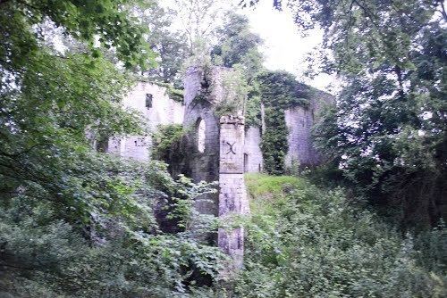
Dominating the town on the road leading north to Avesnes-le-Comte), it presents an abrupt wall into the valley and the forest with the ruins of some round towers. The moat surrounding the fortress is preserved and can be visited. Some parts are overgrown and inaccessible. The vestiges of the round towers are hidden on their exterior face, but the entrance is well restored. The interior allows an understanding of the dimensions of the dwelling space available to the lord of the manor, with its walls and double bays of the Great Hall, below which one can see the
moat and a preserved section of the keep or ‘donjon’.