
 | ||
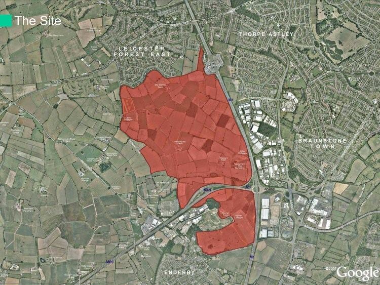
Lubbesthorpe is a hamlet and parish in the district of Blaby within Enderby on the outskirts of Leicester, on the west side of the M1 motorway and the River Soar.
Contents
Map of Lubbesthorpe, UK
Name
The name is said to mean Lubba's Thorpe, i.e. a small settlement belonging to Lubba, an Old English name. It has been spelled as Lubbersthorpe.
History
It was listed in the Domesday Book as a group of nine households. In 1302 there was a chantry chapel, founded by Roger la Zouch, and in about 1534 a manor house (described as "a very faire and gallant house") built by the Earl of Huntingdon. By 1810 these were both ruins and the stone was being removed for road mending. In 1872 it had a population of 64 and belonged to the Duke of Rutland, rising to 118 in 1921.
It was established as a full civil parish in 1866, with various additions and removals changing its area afterwards.
Current
The current houses are a little away from the medieval settlement, the remains of which are now a Scheduled Ancient Monument. (A rabbit warren here is also a Scheduled Ancient Monument.)
A new housing estate of 4250 homes is planned, informally known as New Lubbesthorpe.