
Car plates LLB | Area 1,290 km² | |
 | ||
Gminas Total 13 (incl. 1 urban)LubartówGmina AbramówGmina FirlejGmina JeziorzanyGmina KamionkaGmina KockGmina LubartówGmina MichówGmina NiedźwiadaGmina Ostrów LubelskiGmina OstrówekGmina SernikiGmina Uścimów Points of interest Muzeum Zamoyskich, Kozłówka Palace, Pałac Sanguszków, Jezioro Firlej - plaża, Pałac Jabłonowskich | ||
Lubartów County (Polish: powiat lubartowski) is a unit of territorial administration and local government (powiat) in Lublin Voivodeship, eastern Poland. It was established on January 1, 1999, as a result of the Polish local government reforms passed in 1998. Its administrative seat and largest town is Lubartów, which lies 25 kilometres (16 mi) north of the regional capital Lublin. The county also contains the towns of Kock, lying 23 km (14 mi) north-west of Lubartów, and Ostrów Lubelski, 18 km (11 mi) east of Lubartów.
Contents
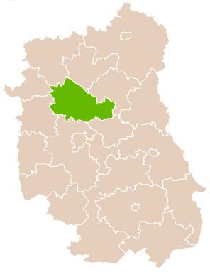
Map of Lubart%C3%B3w County, Poland
The county covers an area of 1,290.35 square kilometres (498.2 sq mi). As of 2006, its total population is 90,484, out of which the population of Lubartów is 22,950, that of Kock is 3,478, that of Ostrów Lubelski is 2,245, and the rural population is 61,811.
Neighbouring counties
Lubartów County is bordered by Łuków County and Radzyń Podlaski County to the north, Parczew County to the north-east, Łęczna County to the south-east, Lublin County to the south, and Puławy County and Ryki County to the west.
Administrative division
The county is subdivided into 13 gminas (one urban, two urban-rural and 10 rural). These are listed in the following table, in descending order of population.