
Length 79.2 km | ||
 | ||
Existed: 1955 renumbering – present Parishes | ||
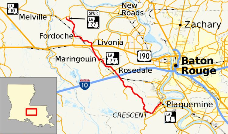
Louisiana Highway 77 (LA 77) is a state highway in Louisiana that serves Iberville and Pointe Coupee parishes. It spans 49.2 miles (79.2 km).
Contents
Map of LA-77, Louisiana, USA
Route description
LA 77 travels southward from LA 10 near the old Melville Ferry roadway in Pointe Coupee Parish through Fordoche and Livonia. In Iberville Parish, it is the primary route from Plaquemine to the northern communities of Maringouin, Rosedale, and Grosse Tete. It parallels Bayou Grosse Tete for much of its course, and the landscape is mostly composed of sugarcane fields and forests along the bayou. LA 77 turns southeastward across a drawbridge over Bayou Grosse Tete and the Intracoastal Canal and parallels Bayou Plaqemine on the western bank before ending at Louisiana Highway 1 near The Island Country Club in Plaquemine.
Spur route
Louisiana Spur Highway 77 (Spur LA 77) is a 1.4-mile-long (2.3 km) highway that covers a glitch in the state highway system. The current LA 77 follows the routing of the original Jefferson Highway, and the LA 77 alignment follows the old road to meet LA 10 West. However, this shortcut is used to reach Morganza, to the northeast of Livonia.
Junction list
The entire highway is in Pointe Coupee Parish.