
Length 84.2 km | ||
 | ||
Parishes Vermilion Parish, Louisiana, Lafayette Parish, Louisiana, Acadia Parish, Louisiana, St. Landry Parish, Louisiana | ||
Louisiana Highway 35 (LA 35) is a 52.3 miles (84.2 km)-long north-south state highway in Louisiana that serves Vermillion, Lafayette, Acadia, and Saint Landry parishes, extending from Louisiana Highway 82, intersecting with exit 87 of Interstate 10, ending at US Route 190.
Contents
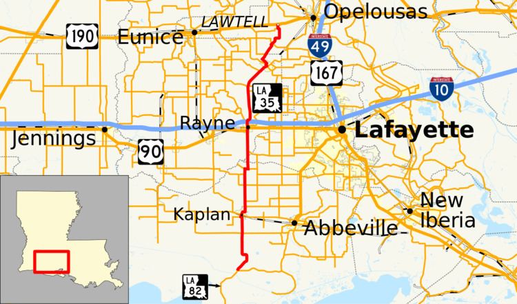
Map of LA-35, Louisiana, USA
Route description
The highway begins as a split of LA 82, and goes northeast as LA 692 cuts at it, LA 14 makes a 4-way intersection at Kaplan, and LA 696 intersects as well. LA 699 makes an intersection just before LA 92 collides with the highway. There, LA 705 ends, while LA 35 remains north, as LA 92 continues east. It makes a short appearance in Lafayette Parish before entering Acadia Parish. Once there, LA 342 ends, and at Rayne, U.S. 90 collides for a short time. Downtown, LA 98 ends, and it makes an intersection with Interstate 10. The combined highway then revives LA 98, while LA 35 goes northeast. LA 1102 ends, LA 365 intersects, and LA 370 also ends before the highway enters Church Point. There, it intersects with LA 95 and LA 178, then sees LA 751 end at the border into St. Landry Parish. LA 358 is the last road that interacts with the highway, as it ends at U.S. 190 just up north.
History
Prior to the 1955 Louisiana Highway renumbering, LA 35 was a road from Amite to Bogalusa via Franklinton. In 1955 the Amite-to-Franklinton segment became part of LA 16, and the Franklinton-to-Bogalusa segment became part of LA 10.