
Width 23 km (14.3 mi) Region Qikiqtaaluk Area 1,312 km² | Length 78 km (48.5 mi) Population Uninhabited | |
 | ||
Island groups Canadian Arctic Archipelago, Queen Elizabeth Islands | ||
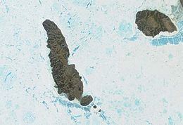
Lougheed Island is one of the uninhabited islands of the Canadian Arctic Archipelago in the Qikiqtaaluk Region, Nunavut. It measures 1,312 km2 (507 sq mi) in size. It is relatively isolated compared to other Canadian Arctic islands, and is located in the Arctic Ocean, halfway between Ellef Ringnes Island to the northeast and Melville Island to the southwest. It is part of the Findlay Group.
Contents
Map of Lougheed Island, Baffin, Unorganized, NU, Canada
History
The first known sighting of the island was in 1916 by Vilhjalmur Stefansson, during his Canadian Arctic Expedition.
On April 14, 1993, Environment Canada revoked a permit issued to Panarctic Oils Ltd. to dispose of 400 tonnes of scrap metal in the ocean off Lougheed Island. The decision was taken in response to concerns expressed by residents of Grise Fiord, Resolute, Arctic Bay and Pond Inlet. Instead of disposing of the material at sea, a research project was initiated to evaluate the environmental impact of stockpiling scrap metal on Lougheed Island.
In 1994, Larry Newitt of the Geological Survey of Canada and Charles Barton of the Australian Geological Survey Organization established a temporary magnetic observatory on Lougheed Island, close to the predicted position of the North Magnetic Pole, in order to monitor short-term fluctuations of the Earth's magnetic field.