
Length 68 km (42 mi) Elevation gain/loss +527 m (1,729 ft) | Use Hiking Trail difficulty Moderate | |
 | ||
Designation National Waymarked Trail | ||
Lough derg way arra mountains co tipperary ireland
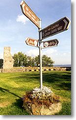
The Lough Derg Way is a long-distance trail in Ireland. It is 68 kilometres (42 miles) long and begins in Limerick City and ends in Dromineer, County Tipperary. It is typically completed in three days. It is designated as a National Waymarked Trail by the National Trails Office of the Irish Sports Council and is managed by Shannon Development, Tipperary County Council and Tipperary Integrated Development Company. The trail was reconfigured and relaunched in 2011 with many sections taken off road aided by an investment of €115,000 under the Comhairle na Tuaithe Walks Scheme, which supports landowners to maintain trails that cross their land.
Contents
The trail follows the River Shannon and its associated canals from Limerick City to Dromineer on the banks of Lough Derg. Along the way it passes the towns and villages of Clonlara, O'Brien's Bridge, Killaloe, Ballina and Garrykennedy. The trail connects with the East Clare Way at Killaoe.