
Discharge 180 m³/s | Length 481 km Basin area 11,254 km² Mouth Garonne Bridges Pont Valentré | |
 | ||
Main source Cévennes1,499 m (4,918 ft) Basin size 11,254 km (4,345 sq mi) | ||
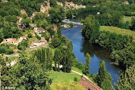
The Lot, [lɔt], originally the Olt (Occitan: Òlt; Latin: Oltis), is a river in France. It is a right tributary of the Garonne. It rises in the Cévennes, flowing west through Quercy, where it flows into the Garonne near Aiguillon, a total distance of 481 kilometres (299 mi). It gives its name to the departments of Lot and Lot-et-Garonne.
Contents
- Map of Lot France
- Main tributariesEdit
- Departments and townsEdit
- HistoryEdit
- The lower LotEdit
- En routeEdit
- The upper riverEdit
- References
Map of Lot, France
The Lot is prone to flooding in the winter and spring.
Olt is also the name of a river in Romania (Romanian: Olt; German: Alt; Latin: Aluta or Alutus, Turkish: Oltu, Ancient Greek: Ἄλυτος Alytos).
Main tributariesEdit
Departments and townsEdit
The Lot flows through the following departments and towns:
HistoryEdit
The river was used for transport as early as the 12th century when 11 flash locks were installed between Penne-d'Agenais and Fumel. A reliable route was not provided until the 17th century when Jean-Baptiste Colbert ordered new works. By 1776, the river had 12 locks. New construction was begun in 1835 for some 297 kilometres (185 mi) and 76 locks, connecting Le Moulin d'Olt at Entraygues to the Garonne at Nicole. Four tunnels were included at this time with lengths from 139 to 364 metres (456 to 1,194 ft). Railway competition caused the abandonment of Lot navigation in 1926. Over the next 60 years, there were no repairs or maintenance of the canal. Repairs in the Lower Lot began in the end of the 1990s.
The lower LotEdit
This portion of the Lot is a 71.5-kilometre (44.4 mi) route, with 7 locks, from Nicole to Lustrac (commune of Trentels). The lower Lot is open to traffic and is being extended upstream with the objective of some day being connected to the upper Lot.
En routeEdit
The upper riverEdit
This portion of the Lot is a 72.5-kilometre (45.0 mi) route, with 17 locks, from Luzech to Larnagol. It was reopened to boats in May 1990.